


As climate and wildfire risks grow, Redfin seems to think homeowners will soon be taking air quality scores into consideration when purchasing their next home.

The Fast Company reports that real estate site Redfin will be adding an air quality factor to the data it provides on home listings. The new air quality factor will join existing flood, heat, and wind factors under a property’s “climate risk” tab; other more traditional tabs include information on the property’s zoning, nearby schools, and the neighborhood. The air quality data will be provided by First Street Foundation, a climate-risk-data provider.
The move comes as a report from First Street shows 25 percent of Americans live in places with healthy air quality. Research from Redfin has also revealed that over 1.2 million people moved away from cities at risk of poor air quality between 2021. While cost could have been a driving factor behind that trend (the same report found that homes in cities at high risk for air quality were also about 65 percent more expensive than those in low risk areas), “a recent survey from Forbes Home found that 30 percent of Americans cite climate change and its accompanying worsening disasters as a motivator for moving in 2024,” reports Kristin Toussaint for Fast Company.
The wildfire smoke that descended on the U.S. East Coast from Canada last summer and talks at the COP26 last November have more recently elevated air quality to a topic of national conversation. While it is a crucial discussion, particularly as climate change intensifies wildfires, it is also important to note that poor air quality driven by factors such as vehicle exhaust and industrial emissions have long been, and continue to be, a significant concern, particularly for people in minority, low-income, and tribal communities, who have long been disproportionately impacted and many of whom don’t have the means to move cities or states to protect their health.
FULL STORY: Looking for a new home? Redfin will now show you air quality data for any property listing

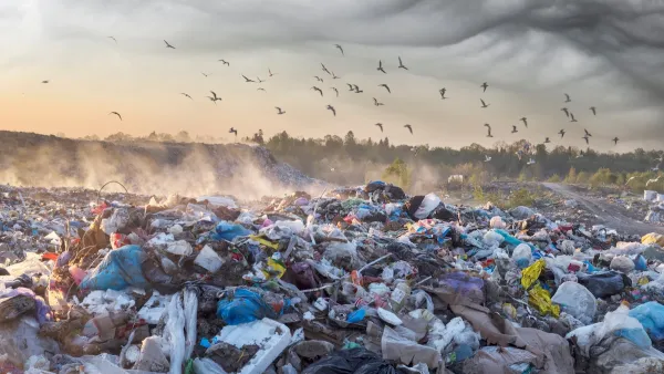
Colorado Landfills Emit as Much Pollution as 1M Cars
Landfills are the third-largest source of methane pollution in Colorado, after agriculture and fossil fuel extraction.

Driving Equity and Clean Air: California Invests in Greener School Transportation
California has awarded $500 million to fund 1,000 zero-emission school buses and chargers for educational agencies as part of its effort to reduce pollution, improve student health, and accelerate the transition to clean transportation.
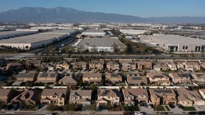
New California Law Regulates Warehouse Pollution
A new law tightens building and emissions regulations for large distribution warehouses to mitigate air pollution and traffic in surrounding communities.

Planetizen Federal Action Tracker
A weekly monitor of how Trump’s orders and actions are impacting planners and planning in America.

Maui's Vacation Rental Debate Turns Ugly
Verbal attacks, misinformation campaigns and fistfights plague a high-stakes debate to convert thousands of vacation rentals into long-term housing.

San Francisco Suspends Traffic Calming Amidst Record Deaths
Citing “a challenging fiscal landscape,” the city will cease the program on the heels of 42 traffic deaths, including 24 pedestrians.

Defunct Pittsburgh Power Plant to Become Residential Tower
A decommissioned steam heat plant will be redeveloped into almost 100 affordable housing units.

Trump Prompts Restructuring of Transportation Research Board in “Unprecedented Overreach”
The TRB has eliminated more than half of its committees including those focused on climate, equity, and cities.

Amtrak Rolls Out New Orleans to Alabama “Mardi Gras” Train
The new service will operate morning and evening departures between Mobile and New Orleans.
Urban Design for Planners 1: Software Tools
This six-course series explores essential urban design concepts using open source software and equips planners with the tools they need to participate fully in the urban design process.
Planning for Universal Design
Learn the tools for implementing Universal Design in planning regulations.
Heyer Gruel & Associates PA
JM Goldson LLC
Custer County Colorado
City of Camden Redevelopment Agency
City of Astoria
Transportation Research & Education Center (TREC) at Portland State University
Jefferson Parish Government
Camden Redevelopment Agency
City of Claremont