


A new map of Virginia illustrates the stark contrasts in pollution burdens depending on location.

A new interactive map of Virginia identifies hotspots of environmental justice failures—where residents face disproportionate public health socioeconomic effects as the result of pollution.
An article by Sarah Vogelsong provides additional insight into the findings of the Mapping for Environmental Justice initiative, which worked with the Virginia Environmental Justice Collaborative and funding from the Earth Island Institute. According to Vogelsong, "the Virginia map assigns a 'cumulative environmental justice impact' score to each census tract in the commonwealth. The higher the score, the greater the tract’s overall environmental impacts and vulnerabilities are considered to be."
According to the initiative's website, parts of Virginia facing disproportionate environmental burdens are "nearly five times more likely to be exposed to air pollution from traffic and are 3.6 times more likely to live near a Superfund site" [emphasis from the original].
"Pollution burden includes data on ozone, particulate matter, lead paint, air toxics, traffic, mines, hazardous waste and high-risk chemical facilities and federal cleanup sites," explains Vogelsong.
FULL STORY: New mapping tool aims to clarify Virginia environmental justice debates


Bioremediation for Environmental Justice
Bioremediation uses plants, fungi, and microbes to clean up polluted land in place, offering a nature-based option for restoring contaminated sites in overburdened communities.

Alabama: Trump Terminates Settlements for Black Communities Harmed By Raw Sewage
Trump deemed the landmark civil rights agreement “illegal DEI and environmental justice policy.”
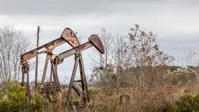
Addressing Orphan Wells for Environmental Justice
Remediating and repurposing some orphan oil and gas wells into parks can turn environmental hazards into community assets, promoting health, environmental justice, and accessible green space for underserved areas.

Maui's Vacation Rental Debate Turns Ugly
Verbal attacks, misinformation campaigns and fistfights plague a high-stakes debate to convert thousands of vacation rentals into long-term housing.

Planetizen Federal Action Tracker
A weekly monitor of how Trump’s orders and actions are impacting planners and planning in America.

Chicago’s Ghost Rails
Just beneath the surface of the modern city lie the remnants of its expansive early 20th-century streetcar system.

Bend, Oregon Zoning Reforms Prioritize Small-Scale Housing
The city altered its zoning code to allow multi-family housing and eliminated parking mandates citywide.

Amtrak Cutting Jobs, Funding to High-Speed Rail
The agency plans to cut 10 percent of its workforce and has confirmed it will not fund new high-speed rail projects.

LA Denies Basic Services to Unhoused Residents
The city has repeatedly failed to respond to requests for trash pickup at encampment sites, and eliminated a program that provided mobile showers and toilets.
Urban Design for Planners 1: Software Tools
This six-course series explores essential urban design concepts using open source software and equips planners with the tools they need to participate fully in the urban design process.
Planning for Universal Design
Learn the tools for implementing Universal Design in planning regulations.
planning NEXT
Appalachian Highlands Housing Partners
Mpact (founded as Rail~Volution)
City of Camden Redevelopment Agency
City of Astoria
City of Portland
City of Laramie