


Communities near transit stations will have to comply with a new set of regulations that support multifamily development and increased housing density.
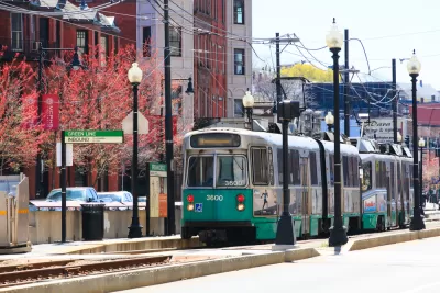
Half of all Massachusetts towns will have to comply with a newly released set of rules governing multifamily zoning in areas near transit stations, reports Colin A. Young for the Lowell Sun.
Known as ‘MBTA communities,’ after the Massachusetts Bay Transportation Authority, 175 cities and towns are now required to meet certain conditions to continue receiving state funding from several major sources. “The multifamily housing districts must have a minimum gross density of 15 units per acre; be no more than half a mile from a commuter rail station, subway station, ferry terminal or bus station; have no age restrictions; and be suitable for families with children.”
In a letter, Secretary of the Executive Office of Housing and Economic Development (EOHED) Mike Kennealy and Undersecretary Jennifer Maddox wrote, “This law is not a housing production mandate. It is all about setting the table for more transit-oriented housing in the years and decades ahead — which is not just good housing policy, but good climate and transportation policy, too.”
The letter also detailed changes made to the law since the first draft. According to Young, “A minimum land area requirement was dropped, the unit capacity requirement was reduced for communities with a population less than 7,000 or fewer than 500 residents per square mile, ‘circuit breakers’ were installed to keep multifamily unit capacity from surpassing 25% of a community’s existing housing stock, and the rule about what portion of a multifamily zoning district must be within a half mile of a transit station was tailored to be more specific to each community.”
FULL STORY: State finalizes multifamily housing rules for MBTA communities


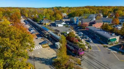
Massachusetts TOD Law Yielding Results
While some cities are fighting the state’s push to increase density near transit, others are already breaking ground on multifamily projects that will bring hundreds of new housing units online.
Massachusetts Zoning Reform Law Reaches First Deadline
Cities and towns had until January 31 to submit their draft plans for rezoning areas near transit stations to comply with a new state law.
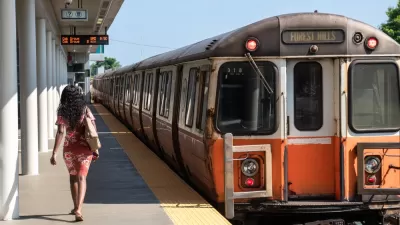
When Transit-Oriented Development Is Missing the ‘Transit’
Cities, residents, and developers have a renewed interest in building more housing near transit stations—when they actually provide safe, reliable transit.

Maui's Vacation Rental Debate Turns Ugly
Verbal attacks, misinformation campaigns and fistfights plague a high-stakes debate to convert thousands of vacation rentals into long-term housing.

Planetizen Federal Action Tracker
A weekly monitor of how Trump’s orders and actions are impacting planners and planning in America.

San Francisco Suspends Traffic Calming Amidst Record Deaths
Citing “a challenging fiscal landscape,” the city will cease the program on the heels of 42 traffic deaths, including 24 pedestrians.

Defunct Pittsburgh Power Plant to Become Residential Tower
A decommissioned steam heat plant will be redeveloped into almost 100 affordable housing units.

Trump Prompts Restructuring of Transportation Research Board in “Unprecedented Overreach”
The TRB has eliminated more than half of its committees including those focused on climate, equity, and cities.

Amtrak Rolls Out New Orleans to Alabama “Mardi Gras” Train
The new service will operate morning and evening departures between Mobile and New Orleans.
Urban Design for Planners 1: Software Tools
This six-course series explores essential urban design concepts using open source software and equips planners with the tools they need to participate fully in the urban design process.
Planning for Universal Design
Learn the tools for implementing Universal Design in planning regulations.
Heyer Gruel & Associates PA
JM Goldson LLC
Custer County Colorado
City of Camden Redevelopment Agency
City of Astoria
Transportation Research & Education Center (TREC) at Portland State University
Jefferson Parish Government
Camden Redevelopment Agency
City of Claremont