


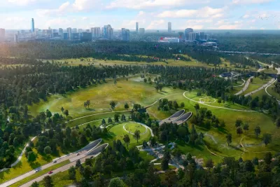
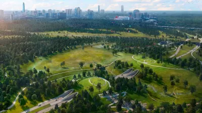
The land bridge over Memorial Drive will return 100 acres of green space to the area and provide a safe, convenient connection for humans and wildlife between the two sides of Memorial Park.
The first part of a 'land bridge' in Houston that will connect the two sides of Memorial Park just opened to the public, reports Dan Carson. "The eastbound passage beneath the park's new land bridge opened to cars on Monday. The westbound tunnel will be greenlit for traffic sometime in May, according to officials."
The bridge, similar to wildlife crossings being built elsewhere, "is part of a long-anticipated bridging of the park's north and south sections, which have been split by Memorial Drive since the space's opening." According to Carson, "The Memorial Park Conservancy on Monday posted video to Instagram of the first cars making the journey through the eastbound tunnel running under the new land bridge, which will add 25 acres of park space once completed."
The one-way tunnels under the bridge will be used exclusively by cars. "Once the westbound tunnel lanes are opened for travelers—a date is projected for this May, according to officials—work crews will begin the process of tearing up the previously used portions of Memorial Drive and returning the land to nature," adding 100 new acres of green space.
"Further work on the land bridge over the summer will see the addition of new bike paths and dozens of acres of prairie to the park."
FULL STORY: Memorial Park Tunnel is open in Houston

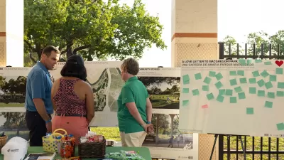
Public and Private Collaboration Advances Park Development in Houston
Houston may be known to some as a concrete jungle, but its greenspaces continue to expand thanks to combined support from the public, private, and philanthropic sectors.
Houston Awarded $18.5M for Trail Linking Uptown and Memorial Park
The grant will make the freeway-bounded park more accessible to pedestrians and cyclists.
Op-Ed: Houston’s Memorial Park Centers Nature, Connectivity
The Houston Chronicle editorial board calls the newly redesigned park a “transformative” project, urging state transportation officials to take note.

Planetizen Federal Action Tracker
A weekly monitor of how Trump’s orders and actions are impacting planners and planning in America.

Chicago’s Ghost Rails
Just beneath the surface of the modern city lie the remnants of its expansive early 20th-century streetcar system.

San Antonio and Austin are Fusing Into one Massive Megaregion
The region spanning the two central Texas cities is growing fast, posing challenges for local infrastructure and water supplies.

Since Zion's Shuttles Went Electric “The Smog is Gone”
Visitors to Zion National Park can enjoy the canyon via the nation’s first fully electric park shuttle system.

Trump Distributing DOT Safety Funds at 1/10 Rate of Biden
Funds for Safe Streets and other transportation safety and equity programs are being held up by administrative reviews and conflicts with the Trump administration’s priorities.

German Cities Subsidize Taxis for Women Amid Wave of Violence
Free or low-cost taxi rides can help women navigate cities more safely, but critics say the programs don't address the root causes of violence against women.
Urban Design for Planners 1: Software Tools
This six-course series explores essential urban design concepts using open source software and equips planners with the tools they need to participate fully in the urban design process.
Planning for Universal Design
Learn the tools for implementing Universal Design in planning regulations.
planning NEXT
Appalachian Highlands Housing Partners
Mpact (founded as Rail~Volution)
City of Camden Redevelopment Agency
City of Astoria
City of Portland
City of Laramie