


The largest infrastructure project in D.C. history is opening this week—first to pedestrians and then to automobile traffic.
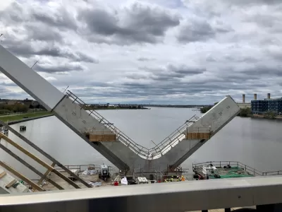
Luz Lazo and Michael Laris report on the debut of the new Frederick Douglass Memorial Bridge, which opened to the public on September 6 and replaced a 71-year-old bridge spanning the Anacostia River in Washington, D.C.
The new bridge is 1,445 feet long and cost $480 million—that latter figure making the new bridge the largest infrastructure project in the history of the District.
"The bridge is not finished. Vises hold up 2-by-4s as makeshift barriers on concrete lookout areas, and paving and connections aren’t complete on wide pedestrian pathways. But Monday’s bridge celebration — starting with a 5K run and walk led by Mayor Muriel E. Bowser — offered expansive views and the chance for many to consider a changing city," according to the article.
Vehicle traffic is expected to start crossing the bridge on Friday and Saturday of this week. "Runners, walkers and stroller-pushers began crossing the span about 9 a.m. Monday as an American flag waved from one of its towering white arches."
The article includes anecdotes and soundbites from the bridges debut on Labor Day. Lazo and Laris also sum up the relevance of the bridge's reopening relative to the larger cultural context and planning history of the District thusly:
The opening of the distinct structure with parallel arcs marks a milestone in the vision to turn the South Capitol Street Corridor into the grand boulevard that Pierre L’Enfant envisioned in his original plan for the nation’s capital. L’Enfant identified the corridor as a symbolic gateway into the District’s monumental core, one that has not been realized as the road maintained a freeway-type configuration that lacked adequate pedestrian and cycling facilities.
FULL STORY: New $480 million Frederick Douglass Memorial Bridge begins opening week with a Labor Day celebration


Iconic New Bridge Project Revealed in D.C.
The new Frederick Douglass Memorial Bridge will span the Anacostia River between Washington, D.C. and Anacostia.
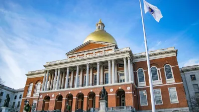
Massachusetts Gov. Makes Case for Road Funding Reforms
A package of proposed bills would change the state’s road funding formula to ensure more money flows to rural areas with limited resources.
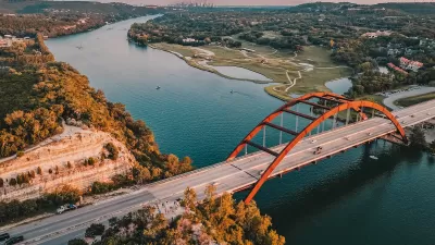
Texas Infrastructure Gets a ‘C’
The American Society of Civil Engineers rates states in 16 categories related to transportation, water, waste management, parks, and more.

Maui's Vacation Rental Debate Turns Ugly
Verbal attacks, misinformation campaigns and fistfights plague a high-stakes debate to convert thousands of vacation rentals into long-term housing.

Planetizen Federal Action Tracker
A weekly monitor of how Trump’s orders and actions are impacting planners and planning in America.

Chicago’s Ghost Rails
Just beneath the surface of the modern city lie the remnants of its expansive early 20th-century streetcar system.

Bend, Oregon Zoning Reforms Prioritize Small-Scale Housing
The city altered its zoning code to allow multi-family housing and eliminated parking mandates citywide.

Amtrak Cutting Jobs, Funding to High-Speed Rail
The agency plans to cut 10 percent of its workforce and has confirmed it will not fund new high-speed rail projects.

LA Denies Basic Services to Unhoused Residents
The city has repeatedly failed to respond to requests for trash pickup at encampment sites, and eliminated a program that provided mobile showers and toilets.
Urban Design for Planners 1: Software Tools
This six-course series explores essential urban design concepts using open source software and equips planners with the tools they need to participate fully in the urban design process.
Planning for Universal Design
Learn the tools for implementing Universal Design in planning regulations.
planning NEXT
Appalachian Highlands Housing Partners
Mpact (founded as Rail~Volution)
City of Camden Redevelopment Agency
City of Astoria
City of Portland
City of Laramie