


An opinion piece written by a Texas Congressional representative explains how the proposed Castner Range National Monument would expand on "America's Best Idea."
Public lands, administered by the National Park Service, the Bureau of Land Management, and state agencies and created through the Antiquities Act and congressional action, have protected millions of acres of land and water from the degradation of humanity, according to an opinion piece written by Rep. Veronica Escobar (D-Texas) and Mark Magaña. But the county's public lands have always been a sad reflection of its broader racial and economic inequities:
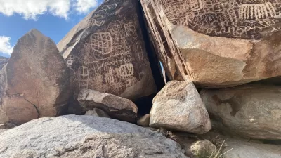
This movement established what many called America's Best Idea, but also reproduced many of the inequalities we see so clearly in so many of our institutions - our federally protected lands, waters, and oceans have for too long been overwhelmingly inaccessible, stripped of their cultural significance to indigenous people, and often unwelcoming to people of color and immigrants.
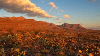
The proposed Castner Range National Monument would change that history, according tp the article, by creating protected open spaces close to the city of El Paso, "home to one of the nation's oldest and largest Latino populations."
The article is pressing for President Joe Biden to invoke the Antiquities Act in declaring the area a national monument, elaborating on the case for Castner Range to be added to the list of lands protected by the federal government:
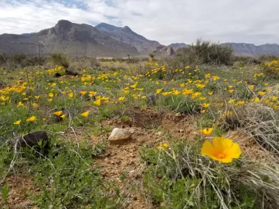
Castner Range has all the hallmarks of a 21st century conservation movement centered on justice and equity. It will connect underserved communities of El Paso to the Franklin Mountains and one of the largest urban state parks in the country, where tens of thousands of families enjoy hiking the arroyos, biking, camping - cooking carne asada surrounded by Mexican poppies, barrel cactus, and long views into our sister city of Juárez.
More reasons for President Biden to make the caster Range National Monument official are included in the source article.
FULL STORY: Public lands that look like America

Biden Designates a New National Monument in West Texas
The Castner Range National Monument in West Texas is the second of two new national monuments announced by President Joe Biden this week.
Avi Kwa Ame, Sacred Land in Nevada, to Be Preserved as a National Monument
Hundreds of thousands of acres of land in Clark County, Nevada will be preserved by President Biden under the powers of the Antiquities Act, according to reports.
National Monuments Under Threat From Mining Under New Executive Order
An executive order from the Department of the Interior could gut protections for public lands established under the Antiquities Act.

Planetizen Federal Action Tracker
A weekly monitor of how Trump’s orders and actions are impacting planners and planning in America.

Maui's Vacation Rental Debate Turns Ugly
Verbal attacks, misinformation campaigns and fistfights plague a high-stakes debate to convert thousands of vacation rentals into long-term housing.

San Francisco Suspends Traffic Calming Amidst Record Deaths
Citing “a challenging fiscal landscape,” the city will cease the program on the heels of 42 traffic deaths, including 24 pedestrians.

Defunct Pittsburgh Power Plant to Become Residential Tower
A decommissioned steam heat plant will be redeveloped into almost 100 affordable housing units.

Trump Prompts Restructuring of Transportation Research Board in “Unprecedented Overreach”
The TRB has eliminated more than half of its committees including those focused on climate, equity, and cities.

Amtrak Rolls Out New Orleans to Alabama “Mardi Gras” Train
The new service will operate morning and evening departures between Mobile and New Orleans.
Urban Design for Planners 1: Software Tools
This six-course series explores essential urban design concepts using open source software and equips planners with the tools they need to participate fully in the urban design process.
Planning for Universal Design
Learn the tools for implementing Universal Design in planning regulations.
Heyer Gruel & Associates PA
JM Goldson LLC
Custer County Colorado
City of Camden Redevelopment Agency
City of Astoria
Transportation Research & Education Center (TREC) at Portland State University
Jefferson Parish Government
Camden Redevelopment Agency
City of Claremont