


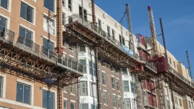
The Washington, D.C. Planning Commission voted to expand the District's inclusionary zoning program, acting a year after the D.C. Office of Planning set out to expand the program.

Nena Perry-Brown reports on changes to the inclusionary zoning program in Washington, D.C., as approved by the District's planning commission earlier this month.
"Under the new framework ('IZ plus'), any mixed-use and residential project that uses map amendments to add density or change a site's use from non-residential to residential must designate 10% to 20% of the residential space to IZ units," explains Perry-Brown. More details on the exact details of the changes are included in the source article.
Prior to the changes, the District's inclusionary zoning program was credited with facilitating the production of 1,2000 affordable units since 2011. D.C. Office of Planning Director Andrew Trueblood is quoted in the article tying the expansion to a push by D.C. Mayor Muriel Bowser to produce more affordable housing in the District.
FULL STORY: DC’s Zoning Commission Approves Expansion of Inclusionary Zoning Requirements


Austin’s ‘Affordability Unlocked’ Initiative Faces Lawsuit
A group of 18 plaintiffs is suing to overturn the city of Austin’s “Affordability Unlocked” planning initiative.

Biden Wants to Incentivize Inclusionary Zoning
Traditionally the purview of local governments, single-family zoning has come under fire as ‘exclusionary.’ Now, the federal government wants to encourage cities to loosen restrictions.
Rent Control Debated in the Nation's Capital
District council members and local tenant advocates are engaged in a bit of tug of war about how far the District should go to limit the amount landlords can raise rents.

Maui's Vacation Rental Debate Turns Ugly
Verbal attacks, misinformation campaigns and fistfights plague a high-stakes debate to convert thousands of vacation rentals into long-term housing.

Planetizen Federal Action Tracker
A weekly monitor of how Trump’s orders and actions are impacting planners and planning in America.

In Urban Planning, AI Prompting Could be the New Design Thinking
Creativity has long been key to great urban design. What if we see AI as our new creative partner?

Portland Raises Parking Fees to Pay for Street Maintenance
The city is struggling to bridge a massive budget gap at the Bureau of Transportation, which largely depleted its reserves during the Civd-19 pandemic.

Spokane Mayor Introduces Housing Reforms Package
Mayor Lisa Brown’s proposals include deferring or waiving some development fees to encourage more affordable housing development.

Houston Mayor Kills Another Bike Lane
The mayor rejected a proposed bike lane in the Montrose district in keeping with his pledge to maintain car lanes.
Urban Design for Planners 1: Software Tools
This six-course series explores essential urban design concepts using open source software and equips planners with the tools they need to participate fully in the urban design process.
Planning for Universal Design
Learn the tools for implementing Universal Design in planning regulations.
Gallatin County Department of Planning & Community Development
Heyer Gruel & Associates PA
JM Goldson LLC
City of Camden Redevelopment Agency
City of Astoria
Transportation Research & Education Center (TREC) at Portland State University
Jefferson Parish Government
Camden Redevelopment Agency
City of Claremont