


A designer was chosen in January, and conceptual rendering were released in July. Project boosters are also pushing an ambitious timeline that would start construction in late 2020.
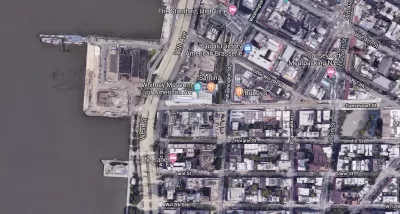
"After decades of planning, a 5.65-acre park with a beach is coming to Hudson River Park’s Gansevoort Peninsula—a site that until recently was a Department of Sanitation facility," reports Valerie Ricciulli.
A preliminary concept was released last week, with designs by James Corner Field Operations—the landscape architecture firm behind the High Line, located nearby.
"The park, located from Gansevoort Street to Little West 12th Street—along what used to be 13th Avenue—will have a sandy beach area with kayak access and a seating area; a salt marsh, habitat enhancements; a large sports field; and on its western side, picnic tables and lounge chairs," according to Ricciulli.
The article debuts the first renderings of the park. Another article by Lizeth Beltran also covers the announcement and provides additional historical perspective on the 20-year germination period for the idea.
The presentation [pdf] delivered to the public on July 24 is currently available on the Hudson River Park Trust's website.
FULL STORY: First look at Gansevoort Peninsula Park along the Hudson River

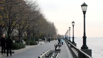
Meet Some of New York City's Newest Parks
In a city where density is everything, these park projects make creative use of existing public spaces—and, in some cases, create their own.
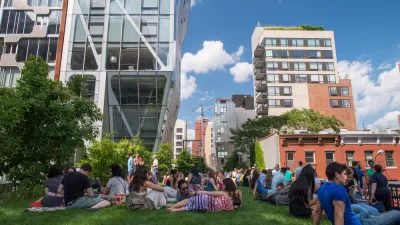
Ten Years of the High Line—Time to Reflect
As the High Line turns ten, a debate about the costs and benefits of urban revitalization continues.
Never Built New York: The Pier 55 Park Project for the Hudson River
The Pier 55 proposal made a big splash in New York when it was proposed in 2014, but now it appears headed for the trash bin of history.

Maui's Vacation Rental Debate Turns Ugly
Verbal attacks, misinformation campaigns and fistfights plague a high-stakes debate to convert thousands of vacation rentals into long-term housing.

Planetizen Federal Action Tracker
A weekly monitor of how Trump’s orders and actions are impacting planners and planning in America.

In Urban Planning, AI Prompting Could be the New Design Thinking
Creativity has long been key to great urban design. What if we see AI as our new creative partner?

King County Supportive Housing Program Offers Hope for Unhoused Residents
The county is taking a ‘Housing First’ approach that prioritizes getting people into housing, then offering wraparound supportive services.

Researchers Use AI to Get Clearer Picture of US Housing
Analysts are using artificial intelligence to supercharge their research by allowing them to comb through data faster. Though these AI tools can be error prone, they save time and housing researchers are optimistic about the future.

Making Shared Micromobility More Inclusive
Cities and shared mobility system operators can do more to include people with disabilities in planning and operations, per a new report.
Urban Design for Planners 1: Software Tools
This six-course series explores essential urban design concepts using open source software and equips planners with the tools they need to participate fully in the urban design process.
Planning for Universal Design
Learn the tools for implementing Universal Design in planning regulations.
planning NEXT
Appalachian Highlands Housing Partners
Mpact (founded as Rail~Volution)
City of Camden Redevelopment Agency
City of Astoria
City of Portland
City of Laramie