


It's a familiar story: artists who flocked to an underused district for the low prices and plentiful space now find themselves inundated by new money, newcomers, and lots of craft beer.
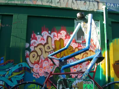
Designated an official arts district in 2002, parts of northeast Minneapolis have long faced pressure from gentrification, the usual bane of lower-income creatives living in the postindustrial corners of American cities. "Between 2000 and 2015," Jessica Lee writes, "the median home value in northeast Minneapolis — the areas of Logan Park, Sheridan, St. Anthony East and St. Anthony West — increased an average of 45 percent, while rents rose an average of 13 percent."
In a process that's been playing out in many cities over the past two decades, artists have inadvertently planted the seeds of their own displacement by nurturing an image of the area as a creatively vibrant locale. "It's this cyclical pushing and shuffling of low-income communities" said Brittany Lewis, an author of a University of Minnesota study on gentrification in Minneapolis since the year 2000.
At the same time, the area's creative economy is humming along, as are adjacent industries. In another gentrification stereotype, Northeast Minneapolis also plays host to what researchers call "the highest concentration of breweries in Minnesota."


Art Walks and Gentrification, a Minneapolis Case Study
Art walks, or open studio tours, often take place in once-gritty neighborhoods trending toward the hip and expensive, but how responsible are the events for the effects of gentrification that emerge?
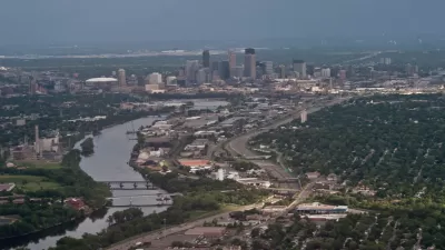
Minneapolis Riverfront Project Raises Issues of Equity
The Upper Harbor Terminal project is set to transform an area north of downtown, but residents are concerned about the long-term impacts and outcomes.
Art in the Face of Gentrification
Art and culture tend to be integral to helping disenfranchised communities self-identify, develop their identities, and organize around place-based issues. But its presence can also be used be used by real estate interests to market neighborhoods.

Maui's Vacation Rental Debate Turns Ugly
Verbal attacks, misinformation campaigns and fistfights plague a high-stakes debate to convert thousands of vacation rentals into long-term housing.

Planetizen Federal Action Tracker
A weekly monitor of how Trump’s orders and actions are impacting planners and planning in America.

In Urban Planning, AI Prompting Could be the New Design Thinking
Creativity has long been key to great urban design. What if we see AI as our new creative partner?

King County Supportive Housing Program Offers Hope for Unhoused Residents
The county is taking a ‘Housing First’ approach that prioritizes getting people into housing, then offering wraparound supportive services.

Researchers Use AI to Get Clearer Picture of US Housing
Analysts are using artificial intelligence to supercharge their research by allowing them to comb through data faster. Though these AI tools can be error prone, they save time and housing researchers are optimistic about the future.

Making Shared Micromobility More Inclusive
Cities and shared mobility system operators can do more to include people with disabilities in planning and operations, per a new report.
Urban Design for Planners 1: Software Tools
This six-course series explores essential urban design concepts using open source software and equips planners with the tools they need to participate fully in the urban design process.
Planning for Universal Design
Learn the tools for implementing Universal Design in planning regulations.
planning NEXT
Appalachian Highlands Housing Partners
Mpact (founded as Rail~Volution)
City of Camden Redevelopment Agency
City of Astoria
City of Portland
City of Laramie