


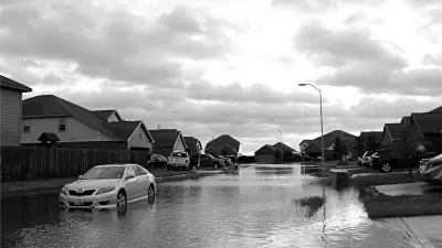
More Americans are moving to high-risk flood zones as environmental deregulation wins the day.

Significant residential and commercial development is increasing the population in flood zones around the country, according to an analysis by Governing.
"Nationally, the number of Americans living in these high-risk areas in 2016 climbed 14 percent compared to those living in the same neighborhoods in 2000. That's actually faster than in areas outside of flood zones, where the population increased 13 percent … In fact, nearly all states recorded net population gains across their FEMA-designated floodplains in recent years."
The federal government has taken significant steps to allow more development in floodplains—like scrapping the Flood Risk Management Standard and scaling back the Waters of the United States Rule—but cities are guilty of trying to skirt restrictions as well, as writer Mike Maciag details. And for people already living in flood zones, it's easier to get disaster assistance than relocation assistance.
In a case study of South Carolina's Johns Island, Maciag concludes that better coordinated planning among jurisdictions could result in more holistic protection of watersheds and safer development. "The best solution would be a unified, interconnected drainage plan for the entire island rather than one that has developers accounting only for their individual properties," he suggests.
FULL STORY: RISKY WATERS


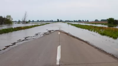
Floodplain Development Largely Concentrated in Gulf Coast States
Many U.S. cities use ‘routine’ practices like zoning changes and permitting to discourage development in high-risk flood zones.
NPR: HUD Sells Flood-Prone Homes Without Disclosing Risks
The troubling trend is particularly pronounced in lower-income communities, where experts worry households are being inadvertently set up for big financial losses.
Most Americans Unaware of Flood Risks, Study Finds
The lack of disclosure laws in most states has led to an overvaluation of homes located in floodplains across the country.

Maui's Vacation Rental Debate Turns Ugly
Verbal attacks, misinformation campaigns and fistfights plague a high-stakes debate to convert thousands of vacation rentals into long-term housing.

Planetizen Federal Action Tracker
A weekly monitor of how Trump’s orders and actions are impacting planners and planning in America.

San Francisco Suspends Traffic Calming Amidst Record Deaths
Citing “a challenging fiscal landscape,” the city will cease the program on the heels of 42 traffic deaths, including 24 pedestrians.

Defunct Pittsburgh Power Plant to Become Residential Tower
A decommissioned steam heat plant will be redeveloped into almost 100 affordable housing units.

Trump Prompts Restructuring of Transportation Research Board in “Unprecedented Overreach”
The TRB has eliminated more than half of its committees including those focused on climate, equity, and cities.

Amtrak Rolls Out New Orleans to Alabama “Mardi Gras” Train
The new service will operate morning and evening departures between Mobile and New Orleans.
Urban Design for Planners 1: Software Tools
This six-course series explores essential urban design concepts using open source software and equips planners with the tools they need to participate fully in the urban design process.
Planning for Universal Design
Learn the tools for implementing Universal Design in planning regulations.
Heyer Gruel & Associates PA
JM Goldson LLC
Custer County Colorado
City of Camden Redevelopment Agency
City of Astoria
Transportation Research & Education Center (TREC) at Portland State University
Jefferson Parish Government
Camden Redevelopment Agency
City of Claremont