


Fire season is back, and it's not safe to breathe in huge swaths of the world.
The Ferguson Fire burning new Yosemite National Park has burned more than 40,000 acres and forced the evacuation of the park.
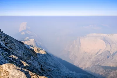
The Ferguson Fire inspired Patrick May to map smoke events around the world, including smoky conditions from wildfires in Colorado and Montana. Fort Smith, Arkansas makes the map for having the highest smoking rate in the entire nation. Around the globe, the tragic fires in Greece are on the map, as do air pollution meters in cities like Cairo, Egypt (as an example of pollution run amok) and Zabol, Iran (as an example of improvement).
Despite broadening the map's scope to include other forms of smoke, it out some smoke events that should worry any one occupying the planet. Earlier this week, for instance, Southern Oregon, a region of natural splendor and home to public lands like Crater Lake National Park, reported the worst air quality in the country due to smoke from wildfires.
The Carr Fire in Shasta County in Northern California was sending ash the size of dimes falling onto the city of Redding, forcing evacuations of historic Old Shasta and neighborhoods in Redding.
FULL STORY: Don’t inhale: a map of smoke events around the world

Wildfire Smoke Affecting Communities Across the Country
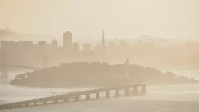
Wildfires in California and Colorado are spewing out smoke that is traveling to other parts of the country. The health effects of the dirty air are substantial, and they could last long after the fires are out.
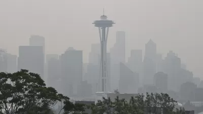
Seattle Clean-Air Shelters to Provide Relief to Residents
Wildfires have caused the city’s air quality to plummet in recent years. The new shelters will give residents a break when the air is not fit to breathe.
Another Summer of Wildfires and Air Quality Emergencies
A third straight summer spent in a haze of smoke from nearby wildfires is taking a psychological toll on Seattle residents. A political response is also taking shape.

Maui's Vacation Rental Debate Turns Ugly
Verbal attacks, misinformation campaigns and fistfights plague a high-stakes debate to convert thousands of vacation rentals into long-term housing.

Planetizen Federal Action Tracker
A weekly monitor of how Trump’s orders and actions are impacting planners and planning in America.

In Urban Planning, AI Prompting Could be the New Design Thinking
Creativity has long been key to great urban design. What if we see AI as our new creative partner?

King County Supportive Housing Program Offers Hope for Unhoused Residents
The county is taking a ‘Housing First’ approach that prioritizes getting people into housing, then offering wraparound supportive services.

Researchers Use AI to Get Clearer Picture of US Housing
Analysts are using artificial intelligence to supercharge their research by allowing them to comb through data faster. Though these AI tools can be error prone, they save time and housing researchers are optimistic about the future.

Making Shared Micromobility More Inclusive
Cities and shared mobility system operators can do more to include people with disabilities in planning and operations, per a new report.
Urban Design for Planners 1: Software Tools
This six-course series explores essential urban design concepts using open source software and equips planners with the tools they need to participate fully in the urban design process.
Planning for Universal Design
Learn the tools for implementing Universal Design in planning regulations.
planning NEXT
Appalachian Highlands Housing Partners
Mpact (founded as Rail~Volution)
City of Camden Redevelopment Agency
City of Astoria
City of Portland
City of Laramie