


The city of Pittsburgh's Open Data project recently released a progress report to commemorate its first two years in operation.

Celebrating two years of open data in the Pittsburgh region and one year since the launch of the Burgh’s Eye View mobile web application (covered by Planetizen in July 2017), "the city’s Digital Services Team released an open data progress report, detailing its accomplishments and efforts to make its data an accessible public asset," report Sanjana Dayananda and Robert Burack.
According to Dayananda and Burack, Pittsburgh has been a national leader in open data since the beginning of the Peduto Administration. The city of Pittsburgh partnered with Allegheny County and the University of Pittsburgh to create the Western Pennsylvania Regional Data Center (WPRDC)—"the country’s first truly regional open data platform."
According to the article, the progress report focuses on user stories in the hoes of demonstrating the usefulness of open data to spur adoption in new communities. For instance, the article details the open data applications that the University of Pittsburgh School of Public Health has employed in fighting the opioid epidemic, as well as the open data used by the city of Pittsburgh in crafting new neighborhood plans in neighborhoods like Homewood and Hazelwood.
FULL STORY: Two Years of Open Data in Pittsburgh


Allegheny County Charts 2024 Transportation Priorities
The region will see expansions in air travel options, Amtrak improvements, and a redesigned bus system to better serve post-pandemic needs.

Pennsylvania Law Removes Obstacles to Blight Reduction
“We don’t need every old coal miner’s house” to stay standing, says Sen. David Argall (R-Schuylkill).
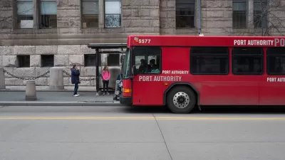
Systemwide Evaluation of Bus Stops Underway in the Pittsburgh Region
The Port Authority of Allegheny County is evaluating how to make improvements at

Maui's Vacation Rental Debate Turns Ugly
Verbal attacks, misinformation campaigns and fistfights plague a high-stakes debate to convert thousands of vacation rentals into long-term housing.

Planetizen Federal Action Tracker
A weekly monitor of how Trump’s orders and actions are impacting planners and planning in America.

Chicago’s Ghost Rails
Just beneath the surface of the modern city lie the remnants of its expansive early 20th-century streetcar system.

Bend, Oregon Zoning Reforms Prioritize Small-Scale Housing
The city altered its zoning code to allow multi-family housing and eliminated parking mandates citywide.

Amtrak Cutting Jobs, Funding to High-Speed Rail
The agency plans to cut 10 percent of its workforce and has confirmed it will not fund new high-speed rail projects.

LA Denies Basic Services to Unhoused Residents
The city has repeatedly failed to respond to requests for trash pickup at encampment sites, and eliminated a program that provided mobile showers and toilets.
Urban Design for Planners 1: Software Tools
This six-course series explores essential urban design concepts using open source software and equips planners with the tools they need to participate fully in the urban design process.
Planning for Universal Design
Learn the tools for implementing Universal Design in planning regulations.
planning NEXT
Appalachian Highlands Housing Partners
Mpact (founded as Rail~Volution)
City of Camden Redevelopment Agency
City of Astoria
City of Portland
City of Laramie