


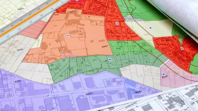
Now open for public comment, a proposed rewrite to the county's zoning code embraces green buildings, lower parking minimums, and increased public engagement by developers.

Taking a favorable view toward the Maryland county's proposed zoning ordinance, "The current zoning ordinance is more than 50 years old [...] In the past several decades, piecemeal updates and amendments to the code have been made to address specific issues or specific areas. The result is a 1,200-page, overly complex code with varying processes, inconsistent standards, regulations within regulations, and a non-intuitive structure."
The new code would require increased attention to green building standards. It would also reduce parking minimums, and even eliminate them for projects next to Metrorail stations.
Another stipulation "would require developers of large projects to meet with members of the public and inform them of their development plans even before an application is submitted to the Planning Department."
"The proposed ordinance is still a draft and has not yet been adopted by the County Council, nor endorsed by the Prince George's County Planning Board. Both the Council and the Prince George's County Planning Department are soliciting comments and suggestions from the public until mid-December."
FULL STORY: Prince George’s zoning code rewrite could make the county greener and less car-dependent


No More Parking Minimums in Hartford
Earlier this month, the Hartford Planning and Zoning Commission voted unanimously on a revised zoning code that lets builders forgo parking citywide.

Spokane Could Eliminate Parking Minimums Near Transit
A Washington state proposal to reduce parking minimums failed in the state legislature earlier this year.
How Zoning Affects Greenhouse Gas Emissions
As the urgency of the climate crisis increases, a paper in the Notre Dame Law Review argues that increased density is not a universally effective strategy to reduce emissions and that different strategies are needed for low-carbon places versus high-carbon ones.

Maui's Vacation Rental Debate Turns Ugly
Verbal attacks, misinformation campaigns and fistfights plague a high-stakes debate to convert thousands of vacation rentals into long-term housing.

Planetizen Federal Action Tracker
A weekly monitor of how Trump’s orders and actions are impacting planners and planning in America.

In Urban Planning, AI Prompting Could be the New Design Thinking
Creativity has long been key to great urban design. What if we see AI as our new creative partner?

King County Supportive Housing Program Offers Hope for Unhoused Residents
The county is taking a ‘Housing First’ approach that prioritizes getting people into housing, then offering wraparound supportive services.

Researchers Use AI to Get Clearer Picture of US Housing
Analysts are using artificial intelligence to supercharge their research by allowing them to comb through data faster. Though these AI tools can be error prone, they save time and housing researchers are optimistic about the future.

Making Shared Micromobility More Inclusive
Cities and shared mobility system operators can do more to include people with disabilities in planning and operations, per a new report.
Urban Design for Planners 1: Software Tools
This six-course series explores essential urban design concepts using open source software and equips planners with the tools they need to participate fully in the urban design process.
Planning for Universal Design
Learn the tools for implementing Universal Design in planning regulations.
planning NEXT
Appalachian Highlands Housing Partners
Mpact (founded as Rail~Volution)
City of Camden Redevelopment Agency
City of Astoria
City of Portland
City of Laramie