


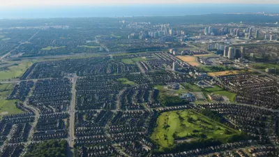
Much of the land use plan is focused on what will not be used -- areas set aside as urban preserves.
"Metro and the partner counties emerged with a plan that designates about 28,000 acres of urban reserves -- land where the urban growth boundary will eventually be expanded -- and slightly more than 272,000 acres of rural reserves that are set aside for farming, forestry and natural areas.
The reserves designations are intended to provide long-term certainty to the regional growth planning process. Farmers, the thinking goes, will be able to confidently make crop and equipment decisions knowing that urban development won't crowd them out for decades to come."
The plan passed in a split vote and still remains controversial among many in the area.
FULL STORY: Metro approves land-use blueprint for Portland-area growth

Nowhere to Build but Up
An old way of doing municipal business—generating development fees by opening farmland to development—is no longer paying dividends. Mississauga, Ontario serves as a cautionary tale for the bottom line of sprawl.
Evaluating the Washington Growth Management Act
The state law that set urban growth boundaries around the state is in its fourth decade as suburban sprawl expands urban growth boundaries around Washington.

Miami-Dade Wants to Add 13 Miles to the Dolphin Expressway
The extended tollway would cut beyond the Urban Growth Boundary into the Everglades.

Planetizen Federal Action Tracker
A weekly monitor of how Trump’s orders and actions are impacting planners and planning in America.

Chicago’s Ghost Rails
Just beneath the surface of the modern city lie the remnants of its expansive early 20th-century streetcar system.

San Antonio and Austin are Fusing Into one Massive Megaregion
The region spanning the two central Texas cities is growing fast, posing challenges for local infrastructure and water supplies.

Since Zion's Shuttles Went Electric “The Smog is Gone”
Visitors to Zion National Park can enjoy the canyon via the nation’s first fully electric park shuttle system.

Trump Distributing DOT Safety Funds at 1/10 Rate of Biden
Funds for Safe Streets and other transportation safety and equity programs are being held up by administrative reviews and conflicts with the Trump administration’s priorities.

German Cities Subsidize Taxis for Women Amid Wave of Violence
Free or low-cost taxi rides can help women navigate cities more safely, but critics say the programs don't address the root causes of violence against women.
Urban Design for Planners 1: Software Tools
This six-course series explores essential urban design concepts using open source software and equips planners with the tools they need to participate fully in the urban design process.
Planning for Universal Design
Learn the tools for implementing Universal Design in planning regulations.
planning NEXT
Appalachian Highlands Housing Partners
Mpact (founded as Rail~Volution)
City of Camden Redevelopment Agency
City of Astoria
City of Portland
City of Laramie