


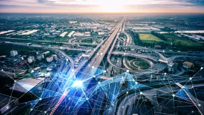
How a ‘control tower’ approach can improve mobility and reduce congestion and emissions.
When it comes to designing transportation solutions that reduce traffic congestion and improve on-time arrival rates, we seem to have a problem. It seems we are focused on all the wrong things. It’s not all about building a better vehicle, or the technology used inside the vehicle. And it’s definitely not about building bigger or more roads and bridges.
It’s about re-engineering the way in which cities move people around. This is important because personal vehicles, mass transit, ridesharing vehicles, commercial vehicles, emergency first responders, and pedestrians are all trying to get from point A to point B in the most efficient manner.
Traffic solutions go beyond bigger roads
Better in-vehicle technology, faster cars, autonomous cars, and more roads will not solve our problem individually. The solution is bigger than each of these, and it must singularly connect, monitor, and orchestrate everyone’s movements in a holistic, technology-agnostic manner.
The journey begins with the traveler's intent to get from point A to point B using the mode(s) that best satisfy their needs for cost and convenience. They could use an app from the service provider or a Mobility as a Service (MaaS) app for a multi-modal trip to make the booking. A mobility service provider, such as a bus system, ride-hailing service, robotaxi, or other public or private entity, provides the journey.
When a journey is booked, the mobility service provider decides which vehicle to send, when to send it, and what route it should take. To do so, the provider uses a cloud-based platform that assigns missions to vehicles’ self-driving technology or drivers’ vehicle receptors. These vehicles can be personal cars and trucks, rideshare cars, emergency vehicles, buses, etc. The platform considers a variety of factors and sends missions that minimize passenger wait times and deadheading for service providers while also meeting their requirements for vehicle utilization and passenger convenience.
Taking a ‘control tower’ approach
It may be beneficial to think of this approach as a car-specific version of an air traffic control tower. Even though many different brands, sizes, and shapes of vehicles are used for air travel, air traffic control is necessary to direct them safely from gate to gate both on the ground and in the air. Both scheduled and on-demand services are offered by commercial airlines and private aircraft, respectively. Air traffic controllers receive service requests from service providers with directions for the vehicles and pilots, including where to go, when they can go there, and which route to take. Service providers submit their reservations or flights with scheduled departure and arrival times.
On the ground, a similar cloud-based “control tower” technology platform can be used to systematically view each mobility provider (car, bus, rail, etc.) and assign signals to each so that they all move in constant harmony and rhythm with each other.
Key to this platform is the integration of traffic signals and intersections with the flow of traffic—which of course changes based on events—work hour vehicle demand, weather patterns and events, and the prioritization of emergency response vehicles that need to move freely through certain corridors. Much of this is already in use in several cities across the U.S., all driven by artificial intelligence (AI).
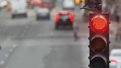
How AI improves the flow of traffic for everyone
AI promises to streamline traffic flow and reduce congestion on many of today’s busiest roadways. Smart traffic light systems and the cloud technology platforms they operate on are now designed to manage and predict traffic more efficiently, which can save a lot of money and create more efficiencies not only for cities but also for individuals. AI and machine learning today can process highly complex data and traffic trends and suggest optimum routing for drivers in real-time based on specific traffic conditions. By integrating everyone’s real-time routing information, cloud-based traffic management systems can now optimize traffic light timing to the true needs of traffic.
Today’s recognition algorithms offer enhanced insights into the mix of density, traffic, and overall rate of flow. Further, these optimized algorithms can leverage data points by region, resulting in a streamlined pattern to reduce traffic problems while redistributing flow more optimally. Municipal traffic management systems can then make better decision-making power, and the control system has a much higher degree of failure tolerance than was previously demonstrated in legacy hub-and-spoke systems.
The combination of AI, machine learning, and cloud-based technology all have great potential to not only improve the throughput of signalized intersections but reimagine them all together. This advanced technology is already in use by transit agencies and emergency first responders, where it is demonstrating a connected, coordinated future between GPS, navigational apps, connected autos, and even taxi and ride-sharing services to efficiently combine mobility data into a traffic control system based on real-time data.
About the author
Timothy Menard is the Founder and CEO of LYT, a provider of cloud-based open-architecture smart traffic solutions. LYT makes traffic lights smart by enabling them to see and respond to traffic. By doing so, LYT can prioritize first responders and public transportation vehicles so they can get to their destinations faster and safer. The system also streamlines overall traffic flow, helping to reduce congestion and emissions in high-traffic areas.


Conservatives’ Decongestion Pricing Flip-Flop
When it comes to solving traffic problems, the current federal administration is on track for failure, waste, and hypocrisy.

The Role of AI in Streamlining Municipal Services and Operations
Explore how artificial intelligence optimizes municipal services, enhancing efficiency in urban planning, traffic management, and public safety.
Boston AI Pilot Optimizes Traffic Light Timing
The program has led to reductions in stop-and-go traffic of as much as 50 percent.

Maui's Vacation Rental Debate Turns Ugly
Verbal attacks, misinformation campaigns and fistfights plague a high-stakes debate to convert thousands of vacation rentals into long-term housing.

Planetizen Federal Action Tracker
A weekly monitor of how Trump’s orders and actions are impacting planners and planning in America.

In Urban Planning, AI Prompting Could be the New Design Thinking
Creativity has long been key to great urban design. What if we see AI as our new creative partner?

Florida Seniors Face Rising Homelessness Risk
High housing costs are pushing more seniors, many of them on a fixed income, into homelessness.

Massachusetts Budget Helps Close MBTA Budget Gap
The budget signed by Gov. Maura Healey includes $470 million in MBTA funding for the next fiscal year.

Milwaukee Launches Vision Zero Plan
Seven years after the city signed its Complete Streets Policy, the city is doubling down on its efforts to eliminate traffic deaths.
Urban Design for Planners 1: Software Tools
This six-course series explores essential urban design concepts using open source software and equips planners with the tools they need to participate fully in the urban design process.
Planning for Universal Design
Learn the tools for implementing Universal Design in planning regulations.
Gallatin County Department of Planning & Community Development
Heyer Gruel & Associates PA
JM Goldson LLC
City of Camden Redevelopment Agency
City of Astoria
Transportation Research & Education Center (TREC) at Portland State University
Jefferson Parish Government
Camden Redevelopment Agency
City of Claremont