


These examples illustrate how biased planning favors longer-distance, motorized travel over shorter, active, affordable, energy efficient, less polluting, and healthier travel options, and sprawl over compact infill development. It's time for reform.

My recent Planetizen column, "Breaking the Cycle of Automobile Dependency," describes how current planning practices reinforce a cycle of increased automobile use, reduced travel options, and more sprawled development. Let me describe two specific examples of this process and the structural reforms needed for more efficient and equitable planning.
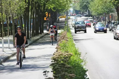
My city, Victoria, BC is currently completing a downtown bicycle network that will cost about $11 million (the project’s budget totalled $14.5 million, but a significant portion involved pedestrian, curb parking and utility line improvements) which has been controversial. Every aspect of the bike network plan was scrutinized by critics who argued that the project is expensive and harms motorists and businesses. According to our regional travel survey, in 2017, 3,820 bicyclists rode to downtown Victoria each weekday morning, so the $11 million spent on downtown bike lanes averages $2,880 per commuter.
In contrast, our provincial government recently announced another $86 million to upgrade Highway 14. This huge expenditure was not at all controversial, although the community it serves, Sooke, has only about 13,000 residents, of which perhaps 4,000 commute to Victoria by car, an expenditure of $21,500 per commuter. Although this project may marginally reduce congestion delays and crash rates on that highway, it contradicts regional planning goals to minimize regional traffic problems and sprawl. This indicates that Sooke automobile commuters receive about ten times as much funding per capita as downtown bicycle commuters, although accommodating more long-distance automobile commutes will increase other transport problems while bicycle improvements can provide many additional benefits.
Here’s another local example. The Malahat is a narrow and steep highway north of Victoria that is often congested and difficult to drive, so the government has commissioned various studies to identify potential improvements. The most recent study, completed in 2007, considered about two dozen highway and passenger rail improvements with costs ranging from about $200 million to $2 billion, or about $10-100 million in direct annualized costs, plus indirect costs from increased vehicle traffic and more sprawled development, and environmental impacts from highway expansion. The study also identified a cheaper approach, provide bus service as an alternative to driving, but this was only implemented in a token way: there are now four buses that travel from Duncan (above the Malahat) to Victoria early each weekday morning and return each afternoon, with a $10 one-way fare. It is unsurprising that this limited (there is no off-peak, reverse commute, evening, or weekend service) and unaffordable (driving seems cheaper than bus fares for most commuters) service attracts relatively few travellers.
A more cost effective and beneficial option, described in the "Rethinking Malahat Solutions" report, is to establish frequent and affordable bus service on the corridor, with transportation demand management (TDM) incentives designed to shift at least 10% of current vehicle trips to the bus. This would reduce traffic congestion, and because higher-risk drivers (young, old, impaired, or driving unreliable vehicles) are most likely to shift mode, and because most casualty crashes involve multiple vehicles, a 10% shift from driving to bus should provide a 15-20% reduction in total crash casualties, this could provide large safety benefits. The box below lists various benefits provided by this solution.
|
Additional Benefits of Multimodal Solutions Compared with roadway expansions, improving and encouraging walking, bicycling and public transit provides the following additional benefits:
|
Despite these potential savings and benefits there are no current plans to implement a multimodal solution over the Malahat.
Why are highway expansion projects approved with little debate or criticism, while more cost effective and beneficial bikeway and bus service improvements controversial and unfunded? Let's consider some biases in the current planning and funding process, and how they could be corrected.
The way transportation activity is measured favors motorized over active modes. Common transport statistics, such as census data and older travel surveys, tend to ignore or undercount walking and bicycling trips because they ignore short trips (those within a traffic analysis zone), non-commute trips, children’s travel, recreational travel, and non-motorized links of trips that include motorized travel. For example, many surveys categorize a bike-transit-walk trip as simply a transit trip, and ignore the trip from a parked car to a destination even if it involves walking several blocks on public streets. In most communities, 10-20% of total trips are by non-auto modes, and use of these modes tends to increase if walking, bicycling, and public transit conditions improve, indicating latent demands. Claims that walking, bicycling, and public transit demands are insignificant are generally based on incomplete and biased data.
The way transportation problems are defined is also biased in favor of highway expansions to the detriment of non-auto modes. Traditional planning evaluates transport system performance based on vehicle traffic speeds and delay, and sometimes crash and emission rates per vehicle-mile. These problems are used to justify roadway expansions. Conventional planning includes no metrics for problems such as high costs, inadequate mobility for non-drivers, physical inactivity, and the reduced accessibility resulting from sprawl, and so fails to account for many benefits of more multimodal planning.
Another bias is that roadway expansion projects are often justified based on false congestion reduction and safety claims. In most cases, the additional capacity is soon filled with generated traffic, which increases downstream congestion and total accidents. If you ask people, “Do you think that traffic congestion is a serious problem?” they frequently answer yes. If you ask, “Would you rather solve congestion problems by improving roads or by using alternatives such as congestion tolls and other TDM strategies?” a smaller majority would probably choose the road improvement option. This is how transport choices are generally framed. But if you present the choices more realistically by asking, “Would you rather spend a lot of money to increase road capacity to achieve moderate and temporary congestion reductions and bear higher future costs from increased motor vehicle traffic, or implement other types of transportation improvements?” the preference for road building is likely to decline. Truth in planning would probably result in more multimodal planning.
Provincial and state transportation agencies are structured to serve inter-community motor vehicle transportation demands—only a tiny portion of its budget is devoted to active transport (walking and bicycling). Our Ministry of Transportation has lots of money budgeted for highways, so there is no political debate concerning how the project will be funded. In contrast, pedestrian and bicycle facilities and new public transit service require special new budget allocations, and so face scrutiny. Favoring highway expansion over walking, bicycling, and public transit favors long-distance commuters, and therefore sprawl or local travel and therefore urban infill development.
Transportation agencies have abundant funding dedicated to roads, and require developers to spend abundant amounts of money on parking facilities, but walking, bicycling and public transit projects generally require special, new funding allocations which must compete with other public expenditures. About half of roadway funding is generated by fuel taxes and so is considered a user fee; highway advocates often argue that spending this money on other modes is unfair; despite the fact that half of all road spending is funded through general taxes that everybody pays regardless of how they travel.
In addition, motorists as individuals and the motor vehicle industries are more politically organized and socially entrenched than walking, bicycling, and public transit advocacy. Although pedestrians, bicyclists, and transit users are good, we are not very loud. Transportation planning decisions are often presented as a win-lose gift to one group or another, motorists versus pedestrians, bicyclists and transit users, or rural versus urban residents. Motorists seldom recognize the ways they benefit from improvements to other modes, including reduced traffic and parking congestion, reduced risk of being the victim of other drivers' errors, reduced chauffeuring burdens, and travel options that they may need sometime in the future if they cannot drive.
These various biases tend to favor longer-distance over shorter-distance, motorized over active modes, energy intensive over energy efficient, more polluting over less polluting, expensive over affordable, unhealthy over healthy travel options, plus urban expansion over development. There are lots of good reasons to challenge and reform transport planning and funding practices to help create more diverse, and therefore more efficient and equitable transport systems. Below are some key reforms for more multimodal planning.
- Collect more comprehensive travel data, including information on short, non-motorized, non-commute and recreational travel, and latent demand for such travel.
- Recognize the travel demands of people who cannot drive, should not drive, or prefer not to drive. For fairness sake alone, 10-30% of transportation funding should be devoted to non-auto modes to ensure that everybody, including non-drivers, receive a fair share of public investments.
- Apply comprehensive analysis of the costs and benefits of each option, including consideration of downstream and indirect impacts. Described differently, evaluate individual planning decisions to ensure that they support strategic goals including affordability, equity, safety and health, and environmental protection.
- Reform funding practices to apply least cost planning principles, which fund the most cost effective solutions, considering all impacts, which allows non-auto modes and Transportation Demand Management solutions to be considered along with capacity expansions.
- Develop new local funding options [pdf] for walking, bicycling, and public transit improvements.
- Report transportation expenditures based on annual sending per capita. This generally shows that non-auto modes and non-drivers as a group receive less than their share of state, provincial, and regional transport expenditures, particularly if the costs of government mandated parking subsidies are considered.
- Do a better job of communicating the many benefits of multimodal transport planning, including benefits to motorists. Emphasize the win-win benefits of improving walking, bicycling and public transit.
For More Information
ADB (2009), Changing Course: A New Paradigm for Sustainable Urban Transport, Asian Development Bank.
Michelle DeRobertis, John Eells, Joseph Kott, and Richard W. Lee (2014), “Changing the Paradigm of Traffic Impact Studies: How Typical Traffic Studies Inhibit Sustainable Transportation,” ITE Journal, May, pp. 30-35.
FDOT (2014), Multimodal Transportation Best Practices and Model Element, Report BDK85-977-49, National Center for Transit Research, Florida Department of Transportation.
Matthew Holian and Ralph McLaughlin (2016), Benefit-Cost Analysis for Transportation Planning and Public Policy: Towards Multimodal Demand Modeling, Mineta Transportation Institute for the California Department of Transportation.
Hanna Hüging, Kain Glensor and Oliver Lah (2014), The TIDE Impact Assessment Method for Urban Transport Innovations: A Handbook For Local Practitioners, TIDE (Transport Innovation Deployment for Europe) Project (www.tide-innovation.eu).
Todd Litman (2013), “The New Transportation Planning Paradigm,” ITE Journal, Vo. 83, No. 6, pp. 20-28.
Todd Litman (2018), Toward More Comprehensive and Multi-modal Transport Evaluation, Victoria Transport Policy Institute.
Wesley Marshall, Daniel Piatkowski and Chris McCahill (2019), “[Re]Evaluating How We Value Transportation,” Research in Transportation Business & Management.
UKDfT (2013), New Approach to Transport Appraisal, UK Department for Transport.


Maui's Vacation Rental Debate Turns Ugly
Verbal attacks, misinformation campaigns and fistfights plague a high-stakes debate to convert thousands of vacation rentals into long-term housing.

Planetizen Federal Action Tracker
A weekly monitor of how Trump’s orders and actions are impacting planners and planning in America.

San Francisco Suspends Traffic Calming Amidst Record Deaths
Citing “a challenging fiscal landscape,” the city will cease the program on the heels of 42 traffic deaths, including 24 pedestrians.

Defunct Pittsburgh Power Plant to Become Residential Tower
A decommissioned steam heat plant will be redeveloped into almost 100 affordable housing units.

Trump Prompts Restructuring of Transportation Research Board in “Unprecedented Overreach”
The TRB has eliminated more than half of its committees including those focused on climate, equity, and cities.

Amtrak Rolls Out New Orleans to Alabama “Mardi Gras” Train
The new service will operate morning and evening departures between Mobile and New Orleans.
Urban Design for Planners 1: Software Tools
This six-course series explores essential urban design concepts using open source software and equips planners with the tools they need to participate fully in the urban design process.
Planning for Universal Design
Learn the tools for implementing Universal Design in planning regulations.
Heyer Gruel & Associates PA
JM Goldson LLC
Custer County Colorado
City of Camden Redevelopment Agency
City of Astoria
Transportation Research & Education Center (TREC) at Portland State University
Jefferson Parish Government
Camden Redevelopment Agency
City of Claremont