


San Antonio is changing, and the city's land use regulations aren't living up to the desires of the city's communities, according to one local architect and planner.
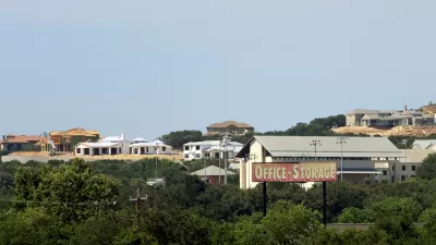
"These days, infill projects are everywhere in the collar neighborhoods [of San Antonio]," according to an article by Jim Bailey. Collar neighborhoods (i.e., "the ring of historic streetcar suburbs around downtown), like Lavaca, Dignowity Hill, and Tobin Hill are under the greatest price-point pressure, but infill is found in many other neighborhoods and could continue to spread.
According to Bailey, "[w]ith our population expected to increase by 1 million people over the next quarter-century and a renewed interest in living the good life in non-auto-dependent, economically integrated neighborhoods, these pressures will continue to mount."
While all this infill pressure is building, Bailey writes that battles between developers, neighbors, designers, and planners are getting ugly. To answer the question of why that is, Bailey proposes the following answer: "There is a disconnect between our desire for walkable traditional neighborhoods and what our development code was designed to accommodate."
The article then goes on to provide more insight into the workings of San Antonio's Unified Development Code, its 2015 Comprehensive Plan, and the overlays and exceptions in the code responsible, according to Bailey, for some of the planning and development confusion in the city's communities.
FULL STORY: Infill Development Could Make or Break San Antonio


D.C. Comprehensive Plan Update Needs Equity Improvements, Report Says
The new D.C. Office of Equity has produced an evaluation of proposed changes to the D.C. Comprehensive Plan.

Comprehensive Plan Update Stokes Controversy in D.C.
Complex political dynamics are mustering for a showdown over D.C.'s comprehensive plan.

Final Renovation Plan for the Alamo Plaza Approved
The San Antonio City Council culminated years of planning and design this week by approving a plan to overhaul the Alamo Plaza.

Maui's Vacation Rental Debate Turns Ugly
Verbal attacks, misinformation campaigns and fistfights plague a high-stakes debate to convert thousands of vacation rentals into long-term housing.

Planetizen Federal Action Tracker
A weekly monitor of how Trump’s orders and actions are impacting planners and planning in America.

San Francisco Suspends Traffic Calming Amidst Record Deaths
Citing “a challenging fiscal landscape,” the city will cease the program on the heels of 42 traffic deaths, including 24 pedestrians.

Defunct Pittsburgh Power Plant to Become Residential Tower
A decommissioned steam heat plant will be redeveloped into almost 100 affordable housing units.

Trump Prompts Restructuring of Transportation Research Board in “Unprecedented Overreach”
The TRB has eliminated more than half of its committees including those focused on climate, equity, and cities.

Amtrak Rolls Out New Orleans to Alabama “Mardi Gras” Train
The new service will operate morning and evening departures between Mobile and New Orleans.
Urban Design for Planners 1: Software Tools
This six-course series explores essential urban design concepts using open source software and equips planners with the tools they need to participate fully in the urban design process.
Planning for Universal Design
Learn the tools for implementing Universal Design in planning regulations.
Heyer Gruel & Associates PA
JM Goldson LLC
Custer County Colorado
City of Camden Redevelopment Agency
City of Astoria
Transportation Research & Education Center (TREC) at Portland State University
Jefferson Parish Government
Camden Redevelopment Agency
City of Claremont