


Visiting the city without zoning.


Last week, I had a mini-summer vacation in Houston—primarily because I thought Houston's combination of no formal zoning code, transit reforms, and a permissive attitude towards building make it worthy of examination. I visited about 16 or 17 different neighborhoods by bus and light rail—if you want a more complete picture (pun intended), feel free to look over my Facebook albums. Although I mostly stayed within Houston's I-610 "Loop" (apparently the boundary between older and newer, more suburb-y areas), I visited both rich and poor neighborhoods.
As a land use professor, I was most interested in the effect of nonzoning. Was Houston chock full of Wal-Marts in the middle of residential areas? Or does Houston look just like other Sun Belt areas? The right answer was: "somewhere in between." I saw no large-scale retail in residential zones. Occasionally, I saw small-scale commercial uses such as antique shops and professional offices, or the occasional car repair shop in poorer neighborhoods. In fact, Houston's residential neighborhoods resembled the zones portrayed by some form-based code I have seen: there was some mixing of uses, but mostly the nonresidential uses were in structures that resembled (and usually, I suspect, once had been) single-family homes.
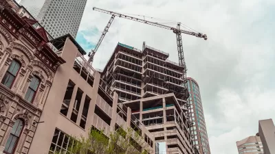
However, the lack of zoning does appear to have affected one type of land use: multifamily structures such as condominiums and apartments. After Houston, I visited San Antonio and Austin. In those cities, apartments and houses are often kept far apart, limiting the supply of rental housing. By contrast, in Houston small multifamily structures often seem to sit right next to houses—even three- and four-story condos! This is true not just in poor areas, but even in high-rent areas like Boulevard Oaks. And because I saw new multifamily buildings as well as old ones, it seems to me that this mixture of uses might become more common over time. Evidently, the multifamily lion can lie down with the single-family lamb without anyone getting eaten.
It is conventional wisdom that Houston's density is too low to support public transit; although the city does not regulate use very much, it does (as I have written) regulate density just like other cities. Even inside the Loop, Houston has about 4,700 people per square mile—more than most Sun Belt cities (most of which clock in at around 3000 people per square mile)*, but still low by the standards of the North and Midwest, and too low to support high-class transit service. Even Houston's popular urban neighborhoods, like Montrose and Houston Heights, tend to have about 6000-7000 per square mile—comparable to the citywide average in many Rust Belt cities. Having said that, Houston has improved its bus service in recent years, and does have decent transit service for its density; in addition to a tiny light rail system, its buses run reasonably frequently. In the inner-suburban area where I stayed, buses run every 30 minutes and run till 11 or so. In more urban areas, buses run more frequently: some routes have service every eight or ten minutes during rush hour.
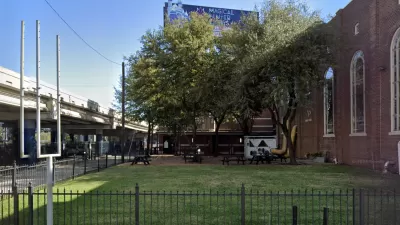
In Houston, as in many other newer cities, parking and setback requirements limit walkability. In the most walkable American neighborhoods, shops are in front of the sidewalk, making pedestrians feel enclosed and minimizing the length of pedestrian trips. However, Houston has historically required shops to have off-street parking and to be set back from the street, so even in Montrose, a pedestrian has to walk through a parking lot to get to those shops. But in Montrose, the parking lots tend to be less overwhelming than outside the Loop.
A common cliche is that Houston is not a planned city. But Houston's street system is better planned than that of my native Atlanta, in two ways. First, Houston has something of a grid system. Although there are some residential dead-end streets, there seems to be a major street every half a mile or so inside the Loop. By contrast, Atlanta suffers from a shortage of east-west streets outside downtown and midtown. Second, Houston seems to me to have more sidewalks than Atlanta: although I certainly saw some residential streets without them even inside the Loop, those streets are the exception rather than the rule.
So do I like Houston? Not as much as the most transit-oriented cities, but more than I expected to.

How Houston Can Be a Model for Housing Reform
The city builds more new housing than almost any other and has dramatically reduced homelessness, yet low-income families struggle to find affordable housing.
Houston Supportive Housing Development Sparks Debate
Critics say a proposed apartment building would negatively impact the neighborhood’s walkability.

How Houston Keeps Housing Affordable
The city’s limited land use regulations have kept housing costs relatively low, but government intervention is still needed to provide housing to the lowest-income residents.

Maui's Vacation Rental Debate Turns Ugly
Verbal attacks, misinformation campaigns and fistfights plague a high-stakes debate to convert thousands of vacation rentals into long-term housing.

Planetizen Federal Action Tracker
A weekly monitor of how Trump’s orders and actions are impacting planners and planning in America.

In Urban Planning, AI Prompting Could be the New Design Thinking
Creativity has long been key to great urban design. What if we see AI as our new creative partner?

King County Supportive Housing Program Offers Hope for Unhoused Residents
The county is taking a ‘Housing First’ approach that prioritizes getting people into housing, then offering wraparound supportive services.

Researchers Use AI to Get Clearer Picture of US Housing
Analysts are using artificial intelligence to supercharge their research by allowing them to comb through data faster. Though these AI tools can be error prone, they save time and housing researchers are optimistic about the future.

Making Shared Micromobility More Inclusive
Cities and shared mobility system operators can do more to include people with disabilities in planning and operations, per a new report.
Urban Design for Planners 1: Software Tools
This six-course series explores essential urban design concepts using open source software and equips planners with the tools they need to participate fully in the urban design process.
Planning for Universal Design
Learn the tools for implementing Universal Design in planning regulations.
planning NEXT
Appalachian Highlands Housing Partners
Mpact (founded as Rail~Volution)
City of Camden Redevelopment Agency
City of Astoria
City of Portland
City of Laramie