


A list of mobile apps that support planning, as part of an annual update. Learn about exciting new ways to explore cities and enhance planning via mobile apps. Please feel free to add your own favorites.

Each year new apps are created to improve people's lives and make everyday tasks easier. Smartphones and other technology put this new information at your fingertips. Apps can be used for educational, entertainment, and personal uses. Terry Barr, a Master's of City and Regional Planning Student at Ohio State University and I have been collecting and evaluating mobile apps looking to share what we see as most useful.
Every year, I survey a cross-section of planners to develop a comprehensive list of some of the most unique, useful, and ubiquitous mobile apps for planners. In December 2016, we have surveyed planners about their professional use of mobile apps, what would they like to see in the future, and what apps either they themselves or their office is developing.
We heard from many planners from across the United States and a few abroad as well. Of the respondents, 99% own either a smartphone or a tablet. Planners who responded were asked about various types of apps they use and the frequency of their use. Around 90% of all planners surveyed stated that they active utilize their mobile device for work purposes, while 44% indicated their employer provides a mobile device. They use a mix of devices operating on the iOS, Android, Windows Phone, and Blackberry operating systems. Planners are using between one and four mobile devices with the median being two devices.
As with previous years, the most commonly used apps by planners in their daily lives are social media apps, such as Twitter and Facebook. Note taking apps are also popular for daily use; and apps like Photoshop, PowerPoint, and Prezi are more frequently used on a monthly basis.
Popular this year are Trello, TripIt, One Note, and Evernote. Mentioned in this year as well as in previous years, planners are using apps such as Google Drive, Dropbox, Box, Google Maps, LinkedIn, and GoToMeeting. Here are a few apps that planners told us about, as well as some I discovered, that are particularly helpful in supporting the work of planners.

- Streets: This app accesses Google Street View but is easier and faster than doing so from Google Maps (iOS).
- Piktochart: A presentation tool that allows for the easy creation of infographics and presentations that are more visually interesting than other presentation platforms (Android and iOS).
- Slack: This is a messaging app that allows you to organize team conversations around projects, plans, or within teams. Users can send direct messages, make calls, and share files (Android, iOS, and Windows Phone).
- Just Press Record: This easy to use voice recorder goes beyond what your built in voice recorder provides, for example providing unlimited recording time, recording in the background while you are using other apps, and offering text transcription in several language (iOS, Apple Watch).
- 500px: This app lets you search your photos by allowing you to draw a sketch of what you are looking for (Android and iOS).
- Enlight: This app features tons of tools to edit photos (iOS).
- Hyperlapse: Hyperlapse allows users to create time lapse videos without the need for a tripod (Android and iOS).
- DashClock: Allows a user to place information, such as weather and appointments, on a home or lock screen. Users don't have to login to see needed information (Android).
- Transit: Transit shows public transportation options, combined with bike sharing and car sharing, allowing people to consider and understand the options for traveling to a destination (Android and iOS).
- IFTTT: If this, then that allows you to automate activities. For example, "if I add a new contact in my email, then save that person's contact information to my notes account." This app also connects to the Internet of Things, allowing users to turn the lights off at a designated time (Android and iOS).
- SideKix: This is a walking navigation app that offers routes based on interests rather than distance, making it easier to discover great places (Android and iOS).
In the survey, planners were asked whether or not their organization has created an app or discussed creating an app. Six percent responded that their organization has created an app or is in the process of creating an app, which is a 6 percent increase from last year. And 69 percent responded that their organization is discussing creating an app in the future, the same as last year. One I really liked is Traffic Agent, being used in Oslo, Norway. This app gathers feedback on pedestrian safety from school children. Children send reports on safety hazards they may encounter while walking to school. The app is distributed by the school to the children, and the school receives the data.
Beyond those being used by survey respondents, here are some recent apps that I found particularly useful.
- Wayfindr: This audio-based navigation system provides personalized instructions for the blind to navigate the London Underground subway system.
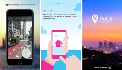
- Go LA: This app allows users in Los Angeles to improve their commute by seeing the shortest, cheapest, and most sustainable method to reach a destination (Android and iOS).
- Look Up: This app reminds pedestrians to look up from their mobile device and check their surroundings before crossing the street (Android).
- Look Up!: Users in the United Kingdom look at roofs and examine whether they might be appropriate for solar panels. If so, the user tags the location to a map and learns how much power could be produced (Android and iOS).
- Streetwyze: This neighborhood navigator includes photos, audio, video, and text provided by people in the neighborhood. This app is in beta, still yet to release to the public.
- WeSense: Users in Amsterdam provide responses to their perceptions about the users perception of your current surroundings and your wellbeing, who you're with, where you are, and what you're doing. The data is sent to faculty at the Technical University of Delft (iOS).
- BikeRider: This intermodal route planning app is being used by the European Union to incentivize the reduction of CO2 emissions in Germany, Finland, and Italy. Players collect leaves for every kilometer ridden on a bike and the rider that has ridden the most in a month wins a tree planted as part of the city's tree initiative. This pilot project ended in the fall of 2016.
And because city planners like to have fun too, here are a couple games that planners may find amusing. Mini Metro is a subway simulator that allows players to to reroute tracks to address demand at an ever-increasing number of stations (Android and iOS). And, of course, there is Pokémon Go, which allows users to explore cities and places while collecting Pokémon (Android and iOS).
All in all it has been a great year for planning and apps that support our communities. May the new year bring even more wonderful advancements in mobile technology to support our cities. I encourage you to share your favorite apps in the comments below and to complete the survey on your use of mobile apps. You can also see the previous years best apps 2016, 2015, 2014, and 2013.


The Best Planning Apps for 2016
A list of mobile apps that support planning, as part of an annual update. Learn about exciting new ways to explore cities and enhance planning via mobile apps. Please feel free to add your own favorites.

The Best Planning Apps for 2015
A list of mobile apps that support planning, as part of an annual update. Learn about exciting new ways to explore cities and enhance planning via mobile apps. Please feel free to add your own favorites.
Best Apps for Urban Planning in 2022
Mobile apps continue to redefine the practices of planning—urban planning, regional planning, transportation planning, community planning, and rural planning included.

Maui's Vacation Rental Debate Turns Ugly
Verbal attacks, misinformation campaigns and fistfights plague a high-stakes debate to convert thousands of vacation rentals into long-term housing.

Planetizen Federal Action Tracker
A weekly monitor of how Trump’s orders and actions are impacting planners and planning in America.

In Urban Planning, AI Prompting Could be the New Design Thinking
Creativity has long been key to great urban design. What if we see AI as our new creative partner?

King County Supportive Housing Program Offers Hope for Unhoused Residents
The county is taking a ‘Housing First’ approach that prioritizes getting people into housing, then offering wraparound supportive services.

Researchers Use AI to Get Clearer Picture of US Housing
Analysts are using artificial intelligence to supercharge their research by allowing them to comb through data faster. Though these AI tools can be error prone, they save time and housing researchers are optimistic about the future.

Making Shared Micromobility More Inclusive
Cities and shared mobility system operators can do more to include people with disabilities in planning and operations, per a new report.
Urban Design for Planners 1: Software Tools
This six-course series explores essential urban design concepts using open source software and equips planners with the tools they need to participate fully in the urban design process.
Planning for Universal Design
Learn the tools for implementing Universal Design in planning regulations.
planning NEXT
Appalachian Highlands Housing Partners
Gallatin County Department of Planning & Community Development
Mpact (founded as Rail~Volution)
City of Camden Redevelopment Agency
City of Astoria
City of Portland
City of Laramie