


Thirty years following the start of a project designed to build back land that was slowly being lost to the Gulf of Mexico, Louisiana is celebrating a rare success.
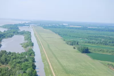
Todd Masson of the New Orleans Times-Picayunereports that a project launched in 1986 by the Louisiana Department of Wildlife and Fisheries continues to exceed expectations in new land creation in southern Louisiana. The Louisiana Crevasse Project involved cutting holes into natural levees in the Pass a Loutre Wildlife Management Area to allow sediment from the Mississippi River to flow into the sinking marshland. Since then, the department has been stunned by the ongoing land creation which may be a model for how the state can claw back land that has rapidly been sinking into the Gulf of Mexico.
This natural process of land creation comes at virtually no cost once the cut has been made and allows for a natural gradient of marsh to form. This low-cost restoration technique is unique as it continues to build additional acreage over time rather than eroding away. It is also the cheapest land-creation technique currently in the coastal-wetland-restoration toolbox, the department said. Having a marsh slowly and naturally recreate itself with varying elevations allows for more diversity in the species that use the habitat.
FULL STORY: Cutting holes in levees has created more land than expected south of Venice

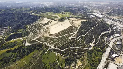
Puente Hills Landfill Redevelopment Plan Wins Award for Transformative, Climate-Responsive Design
This project to transform a former landfill into a climate-resilient public space has won the 2024 Global Impact Award from ASLA and IFLA for its innovative, community-driven design that addresses environmental and social challenges.
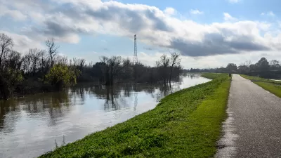
Louisiana Coastal Protection Agency Under Threat
The state’s new governor wants to shrink the power of the agency, which has spearheaded essential flood protection and mitigation efforts since the aftermath of Hurricane Katrina.
Carson to Host California Land Recycling Conference
In September 2024, the Center for Creative Land Recycling will hold its annual conference in Carson, California, offerings opportunities to learn about the reuse of underutilized and contaminated properties.

Montreal Mall to Become 6,000 Housing Units
Place Versailles will be transformed into a mixed-use complex over the next 25 years.

Planetizen Federal Action Tracker
A weekly monitor of how Trump’s orders and actions are impacting planners and planning in America.

DARTSpace Platform Streamlines Dallas TOD Application Process
The Dallas transit agency hopes a shorter permitting timeline will boost transit-oriented development around rail stations.

Interactive Map Reveals America's “Shade Deserts”
Launched by UCLA and American Forests to combat heat-related deaths, the tool maps the shade infrastructure for over 360 U.S. cities.

Bicycles and Books — In Sacramento, Libraries Now Offer Both
Adult library card holders can check out e-bikes and e-trikes for up to one week.

Colorado Landfills Emit as Much Pollution as 1M Cars
Landfills are the third-largest source of methane pollution in Colorado, after agriculture and fossil fuel extraction.
Urban Design for Planners 1: Software Tools
This six-course series explores essential urban design concepts using open source software and equips planners with the tools they need to participate fully in the urban design process.
Planning for Universal Design
Learn the tools for implementing Universal Design in planning regulations.
City of Mt Shasta
City of Camden Redevelopment Agency
City of Astoria
Transportation Research & Education Center (TREC) at Portland State University
US High Speed Rail Association
City of Camden Redevelopment Agency
Municipality of Princeton (NJ)