


Vox imagines a world in which cows stage a military coup.
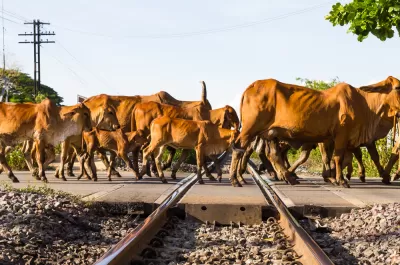
This bit of imaginative explanation by Zachary Crockett asks readers to imagine the results of hypothetical military coup, perpetrated by the nation's cows.
To set the scary but amusing doomsday scenario in motion, Crockett points out the obvious size advantage of cows (i.e., "the wide-eyed, cantankerous varmints outweigh us [Americans] by 66 billion pounds") and their tendency toward violence (i.e., "they maul about 20 of us [Americans] to death each year").
The larger point of the article is to illustrate how much of the country is populated more with bovine than brethren. True, there is one cow for every 3.5 humans in the United States, but there are nine states where humans are easily outnumbered by cows.
Idaho, Iowa, Kansas, Montana, Nebraska, North Dakota, Oklahoma, South Dakota, and Wyoming all have more cows than humans. Nebraska has the largest population of cows, with 6.4 million, and a 3.4 to 1 ratio of cows to humans. South Dakota has the largest ratio of cows to human, 4.5 to 1. The article also includes infographics to illustrate these statistics and come fun cow GIFs, if you're into that sort of thing. Also included is a brief history of how so many of the nation's cows came to reside in the Great Plains.
FULL STORY: If cows staged a revolt against humans, these 9 states would be udderly screwed


Friday Funny: Squirrelly Passenger Causes UK Train Cancellation
Planetizen’s Friday Funny stories are often satirical, but this nutty story from Reuters is 100 percent genuine.

Friday Funny: Gated Community Doubles Down
The Onion skewers suburbia.

Friday Funny: How Much Parking Does That Parking Spot Need?
The Onion takes parking requirements to their logical conclusion.

Planetizen Federal Action Tracker
A weekly monitor of how Trump’s orders and actions are impacting planners and planning in America.

Maui's Vacation Rental Debate Turns Ugly
Verbal attacks, misinformation campaigns and fistfights plague a high-stakes debate to convert thousands of vacation rentals into long-term housing.

Cuomo Is the Candidate of Both NIMBYs and Developers. What Gives?
In the New York City mayoral race, odd bedfellows align to preserve the housing status quo.

The Subversive Car-Free Guide to Trump's Great American Road Trip
Car-free ways to access Chicagoland’s best tourist attractions.

San Antonio and Austin are Fusing Into one Massive Megaregion
The region spanning the two central Texas cities is growing fast, posing challenges for local infrastructure and water supplies.

Charlottesville Temporarily Has No Zoning Code
A judge ordered the Virginia city to throw out its newly revised zoning code, leaving permitting for new development in legal limbo.
Urban Design for Planners 1: Software Tools
This six-course series explores essential urban design concepts using open source software and equips planners with the tools they need to participate fully in the urban design process.
Planning for Universal Design
Learn the tools for implementing Universal Design in planning regulations.
Heyer Gruel & Associates PA
JM Goldson LLC
Custer County Colorado
City of Camden Redevelopment Agency
City of Astoria
Transportation Research & Education Center (TREC) at Portland State University
Jefferson Parish Government
Camden Redevelopment Agency
City of Claremont