


There's still a long way to go to get to the finish line on the conversion of a rail corridor into a bike trail that could connect important parts of the city, but Cincinnati is currently pulling lots of purse strings to make it happen.
Chris Wetterich reports on the goings on with the proposed Wasson Way bike trail in Cincinnati, where local officials recently sent a request for funding from the state to help make the plan a reality.
Mayor John Cranley and City Manager Harry Black sent the letter, which sums up the ambition of the project:
"The trail utilizes an existing, unused rail corridor and, when completed, will connect eight Cincinnati neighborhoods and the communities of Norwood, Mariemont and Fairfax and 83,000 people living within 1 mile of the trail….It will provide alternative access to five major development sites, including sites at Xavier University and near Uptown, and will help make our community more attractive to families and to the talented skilled workforce that will propel the economy of the region."
So far the project has brought in a $500,000 grant from the Ohio Department of Natural Resources and a $12 million purchase agreement with Norfolk Southern Railroad Co. "to buy 4.1 miles of track needed for the project," according to Wetterich. The article includes more details about the funding requirements for the project, along with some maps and conceptual renderings of the potential addition to the city.
FULL STORY: Cincinnati identifies a new source to fund Wasson Way

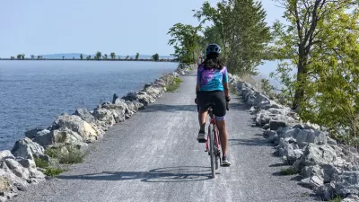
A National Bike Trail Network Is Slowly Growing
Around the United States, new bike lanes and trails are connecting communities via two (or three) wheels.

Advocates Champion the Great Western Trail
A Chicago walking and biking trail along a former railroad right-of-way has been a labor of love for local residents.

Revealed: A Plan to Build a Continuous Bike Trail Across the United States
Motorists have been able to drive across the country for more than a century. People on bikes will get their day soon, too.

Rethinking Redlining
For decades we have blamed 100-year-old maps for the patterns of spatial racial inequity that persist in American cities today. An esteemed researcher says: we’ve got it all wrong.

Planetizen Federal Action Tracker
A weekly monitor of how Trump’s orders and actions are impacting planners and planning in America.

Walmart Announces Nationwide EV Charging Network
The company plans to install electric car chargers at most of its stores by 2030.

New State Study Suggests Homelessness Far Undercounted in New Mexico
An analysis of hospital visit records provided a more accurate count than the annual point-in-time count used by most agencies.

Michigan Bills Would Stiffen Penalties for Deadly Crashes
Proposed state legislation would close a ‘legal gap’ that lets drivers who kill get away with few repercussions.

Report: Bus Ridership Back to 86 Percent of Pre-Covid Levels
Transit ridership around the country was up by 85 percent in all modes in 2024.
Urban Design for Planners 1: Software Tools
This six-course series explores essential urban design concepts using open source software and equips planners with the tools they need to participate fully in the urban design process.
Planning for Universal Design
Learn the tools for implementing Universal Design in planning regulations.
City of Moorpark
City of Tustin
City of Camden Redevelopment Agency
City of Astoria
Transportation Research & Education Center (TREC) at Portland State University
Regional Transportation Commission of Southern Nevada
Toledo-Lucas County Plan Commissions