


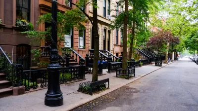
Inside access to a huge volunteer effort underway in New York City to account for the condition of an estimated 600,000 street trees—where every single one of the city's trees counts.
"For the first time ever, the NYC Department of Parks and Recreation is working with thousands of volunteers to measure and map every single street tree on every single block in every single neighborhood in all five boroughs of the city," reports Philip Silva.
The article provides an in-depth look at the mechanics of the effort, dubbed TreesCount! 2015, which has ambitiously deployed 5,000 volunteers (so far) for "old fashioned site-surveying techniques." That means, according to SIlva: "No GPS. No Google Street View. No satellite imagery. Just a $90 measuring wheel, a plastic tape measure, and a meticulously designed data logging website filled to the brim with sophisticated geometry, cartography, and code."
The effort has already mapped 100,000 of the estimated 600,000 trees that call New York City home since it launched in May.
Also explained by Silva is the larger purpose of the census, namely: "NYC Parks, the department that oversees street trees in the Big Apple, wants to know what kinds of challenges each tree is facing and how much effort neighborhood volunteers are putting into keeping trees alive."
FULL STORY: Mapping the Forest for the Trees: A Census Grows in the Five Boroughs


Tree Folio NYC Aims to Monitor Urban Forest in Real Time
A new tool could help the city reach its goal of planting up to 250,000 new trees by 2035.
Looking to Add More Trees? Mind the 'Sidewalk Gray Zone'
A case study provided by the MillionTreesNYC program offers insight into complicated territorial boundaries that can challenge urban greening projects.
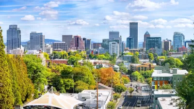
Invasive Beetles Put Oregon Forests at Risk
Two recently discovered borer beetles could lead to a significant loss of tree canopy.

Maui's Vacation Rental Debate Turns Ugly
Verbal attacks, misinformation campaigns and fistfights plague a high-stakes debate to convert thousands of vacation rentals into long-term housing.

Planetizen Federal Action Tracker
A weekly monitor of how Trump’s orders and actions are impacting planners and planning in America.

Chicago’s Ghost Rails
Just beneath the surface of the modern city lie the remnants of its expansive early 20th-century streetcar system.

Bend, Oregon Zoning Reforms Prioritize Small-Scale Housing
The city altered its zoning code to allow multi-family housing and eliminated parking mandates citywide.

Amtrak Cutting Jobs, Funding to High-Speed Rail
The agency plans to cut 10 percent of its workforce and has confirmed it will not fund new high-speed rail projects.

LA Denies Basic Services to Unhoused Residents
The city has repeatedly failed to respond to requests for trash pickup at encampment sites, and eliminated a program that provided mobile showers and toilets.
Urban Design for Planners 1: Software Tools
This six-course series explores essential urban design concepts using open source software and equips planners with the tools they need to participate fully in the urban design process.
Planning for Universal Design
Learn the tools for implementing Universal Design in planning regulations.
planning NEXT
Appalachian Highlands Housing Partners
Mpact (founded as Rail~Volution)
City of Camden Redevelopment Agency
City of Astoria
City of Portland
City of Laramie