


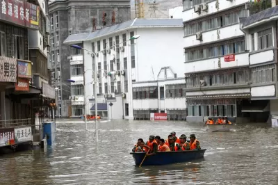
Cartographer Jeffrey Linn has compiled maps of how coastal China would look under risen seas. Over 40 percent of the country's population lives in potentially affected regions.
According to the Intergovernmental Panel on Climate Change (IPCC), "If the current trajectory continues, as many scientists fear it will, the world's sea level will rise dramatically, submerging many of world's current coastlines under more than 200 feet of water."
Following up on his nightmare-scenario maps of Seattle, L.A., San Diego, Portland, and Vancouver under 200 feet of risen sea, cartographer Jeffrey Linn has done the same for coastal China. The article includes several of Linn's depictions, which viewers can scroll over to compare current topography with a submerged future. Some highlights:
- Lowland Shanghai is completely submerged if all polar ice melted.
- Hong Kong is no more, with only hillside developments remaining.
- The Pearl River Delta, considered the world's largest megacity by some, is entirely hollowed out by water.
FULL STORY: Submerged: Mapping a Future China and its Rising Seas


How Cities Can Curb Climate Change and Protect Vulnerable Residents
A new U.N. report urges cities to upgrade their infrastructure to bolster climate resilience and build more sustainable, climate-friendly places.

Bay Area Developments at Risk From Sea Level Rise
A controversial proposed housing development in Newark exemplifies the struggle between increasing housing supply and protecting vulnerable shoreline communities from flooding.

Visualizing the Effects of Sea Level Rise on U.S. Cities
A report from Climate Central calls for urgent action, illustrating the potential devastating impact of even a small rise in global temperature on the coastline of major cities.

Maui's Vacation Rental Debate Turns Ugly
Verbal attacks, misinformation campaigns and fistfights plague a high-stakes debate to convert thousands of vacation rentals into long-term housing.

Planetizen Federal Action Tracker
A weekly monitor of how Trump’s orders and actions are impacting planners and planning in America.

Chicago’s Ghost Rails
Just beneath the surface of the modern city lie the remnants of its expansive early 20th-century streetcar system.

Bend, Oregon Zoning Reforms Prioritize Small-Scale Housing
The city altered its zoning code to allow multi-family housing and eliminated parking mandates citywide.

Amtrak Cutting Jobs, Funding to High-Speed Rail
The agency plans to cut 10 percent of its workforce and has confirmed it will not fund new high-speed rail projects.

LA Denies Basic Services to Unhoused Residents
The city has repeatedly failed to respond to requests for trash pickup at encampment sites, and eliminated a program that provided mobile showers and toilets.
Urban Design for Planners 1: Software Tools
This six-course series explores essential urban design concepts using open source software and equips planners with the tools they need to participate fully in the urban design process.
Planning for Universal Design
Learn the tools for implementing Universal Design in planning regulations.
planning NEXT
Appalachian Highlands Housing Partners
Mpact (founded as Rail~Volution)
City of Camden Redevelopment Agency
City of Astoria
City of Portland
City of Laramie