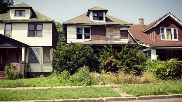
Although Milwaukee had been insulated from population loss compared to many other legacy cities, the Great Recession has required the city to launch an $11.6 million blight reduction program.


Edward McClelland writes of the unique considerations at play in the Milwaukee’s first blight reduction efforts, which has launched as a result of the Great Recession, when the city “had more empty houses than it knew what to do with” for the first time.
But Mayor Tom Barrett’s $11.6 million plan to tear down some 500 homes will run into historic preservation issues that don’t apply in other shrinking cities: “One reason Milwaukee has been so stable is that its housing was built to last for generations. In Detroit, Cleveland, Flint and Buffalo, bungalows were built quickly and cheaply to accommodate waves of factory workers. As those neighborhoods wore out, they were abandoned for suburbia. Milwaukee’s Germans built sturdy, graceful brick two-flats.”
The city’s Neighborhood Services Department will determine which houses will be demolished, and although city code (and a $2.3 million Housing Infrastructure Preservation Fund) allows historic status as a factor in determining whether a house will be saved, the math for which houses get protected and which get destroyed is a bit of an experiment for planners says Michael R. Allen, who directs the Preservation Research Office in St. Louis: “Weighing preservation questions against public safety issues like demolition, condition of structures in very distressed or depleted neighborhoods — there’s no science to it, and I think this is really a sort of emergent area of interest for planners who may see preservationists intruding as a little bit of a nuisance, and preservationists who are learning what preservation really is, because we’re moving from ‘Thou shalt not’ to ‘maybe,’ and that’s a big leap.”
Read the full story: With Demolitions on the Horizon, Milwaukee Preservationists Seek Balance between History & Safety
Federal Agencies Investigating the Rising Costs of Detroit's Blight Program
Detroit's aggressive blight reduction strategy, to demolish vacant homes by the thousands, is coming under scrutiny for rising costs. The FBI and the U.S. Inspector General are investigating.
How Cities Are Stopping the Blight Contagion
Every city with neighborhoods in decline and a lack of demand for new investment is faced with the challenge of how to address blight. Each city's challenges are unique, but many are finding new and effective strategies to end the spread of blight.
Massive Detroit Foreclosures Push Out Black Homeowners
A Detroit reborn sounds great, but what if the residents of “blighted” areas don’t want to leave? Many feel they have no choice in a process that has been compared to racial relocation. Meanwhile, activists scramble to give residents options.

Planetizen Federal Action Tracker
A weekly monitor of how Trump’s orders and actions are impacting planners and planning in America.

Eastern Nebraska is running out of electricity
Data centers and electrification are straining eastern Nebraska’s grid, throttling economic development.

Study reveals best places in the U.S. for cycling, walking
New research from Streetlight Data examines bicycle and pedestrian miles per capita in the 100 largest U.S. cities by population.

DSA members accuse Mamdani of 'abandoning values' over housing redevelopment
New York City's mayor plans to replace about 2,000 units of public housing with private, mixed-income housing.

All sides of BRT debate unhappy with CDOT’s most recent move
The Colorado Department of Transportation is no longer considering center-running bus lanes for Colorado Boulevard.

Massachusetts bogs generate both power, and cranberries
Putting solar panels above farmland is one way Massachusetts is advancing toward its goal of net-zero carbon emissions by 2050.

FREE Course: Walkable City 1: Why Walkability?
After describing his path towards focusing on walkability as the essence of good planning, Jeff Speck marches through his five principal reasons for making more walkable places.
Reinventing Malls: Planning Alchemy—Turning Gray Fields Into Gold
The course focuses on the opportunities and imperatives that shape reinvention of mall sites.

City of Rosemead
Rutgers University, Edward J. Bloustein School of Planning and Public Policy
One Hundred Miles
University of Michigan School for Environment and Sustainability (SEAS)
Hunter College, City University of New York (CUNY)
The Architects Foundation
City of Cambridge
The Pocatello Development Authority
The Urban Renewal Agency of the City of Pocatello