


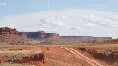
If you fancy yourself a modern-day John Wesley Powell, but to this point haven’t climbed on a raft headed Grand Canyon way, Google recently released a series of “Street View” style photos from the very bottom of that most famous natural landmark.
Maybe you still don’t know what it feels like to be ABC (Alive Below Crystal Falls) with a taco in one hand and a beer in the other, but now you can witness the romance of the Grand Canyon (and maybe learn a little bit about why it needs to be protected).
Felicia Fonseca reports that Google has released the images of a raft trip down the Grand Canyon—the result of a partnership with the American Rivers advocacy group. Although the trekker project has been in the works for some time now, Google just released the photos and an interactive website of the Grand Canyon journey this week.
The Street View Treks page is full of data about the history and formation of the river, including this description: “The Colorado River is one of the most dammed, diverted, and plumbed rivers in the world -- by the time the Colorado River reaches the Gulf of California in Mexico, it’s so tapped out that the river runs dry.” The river’s state led American Rivers to declare the Colorado River "America’s Most Endangered River" in 2013.
FULL STORY: Google cameras take rafting trip at Grand Canyon

'Most Endangered River' in the United States: the Colorado River in the Grand Canyon
American Rivers' list of the "Most Endangered" U.S. rivers provides an annual reminder of the abuse waterways bear in the name of the country's economy and culture.
'Unprecedented' Sale of Public Land Concerns 'Even Some Republicans'
As the Department of the Interior auctions off 'vast swaths' of American wilderness to oil and gas companies, fiscal conservatives and conservationists alike wonder if it’s the right thing at the right time.
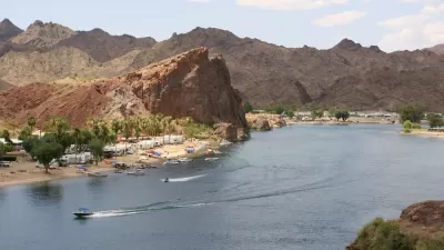
America's 'Most Endangered Rivers' Face New Threats in 2017
The American Rivers advocacy group has released its annual report on the country's most endangered rivers, paying special attention to the threats posed to the country's waterways in new federal policies and budget plans.

Maui's Vacation Rental Debate Turns Ugly
Verbal attacks, misinformation campaigns and fistfights plague a high-stakes debate to convert thousands of vacation rentals into long-term housing.

Planetizen Federal Action Tracker
A weekly monitor of how Trump’s orders and actions are impacting planners and planning in America.

In Urban Planning, AI Prompting Could be the New Design Thinking
Creativity has long been key to great urban design. What if we see AI as our new creative partner?

King County Supportive Housing Program Offers Hope for Unhoused Residents
The county is taking a ‘Housing First’ approach that prioritizes getting people into housing, then offering wraparound supportive services.

Researchers Use AI to Get Clearer Picture of US Housing
Analysts are using artificial intelligence to supercharge their research by allowing them to comb through data faster. Though these AI tools can be error prone, they save time and housing researchers are optimistic about the future.

Making Shared Micromobility More Inclusive
Cities and shared mobility system operators can do more to include people with disabilities in planning and operations, per a new report.
Urban Design for Planners 1: Software Tools
This six-course series explores essential urban design concepts using open source software and equips planners with the tools they need to participate fully in the urban design process.
Planning for Universal Design
Learn the tools for implementing Universal Design in planning regulations.
planning NEXT
Appalachian Highlands Housing Partners
Mpact (founded as Rail~Volution)
City of Camden Redevelopment Agency
City of Astoria
City of Portland
City of Laramie