


An enterprising blogger has produced a slew of urban maps with an overlay of publicly available data on exercise routes. In addition to being fetching, the patterns revealed show how runners make use of the public realm.
Dr. Nathan Yau, PhD, who runs the FlowingDate blog, has produced a series of maps for cities both large and small around the country, using the app RunKeeper to source data. The app Strava, for bikers, according to Dr. Yau, would also work in the same way and has been used to good effect before (although on an individual basis).
As Dr. Yau aptly points out: “[the visualization] can be useful to the data collectors to plan future workouts or even city planners who make sure citizens have proper bike lanes and running paths.”
And here’s Dr. Yau’s initial takeaway about what the maps say about how runners make use of the public realm: “If there's one quick (and expected) takeaway, it's that people like to run by the water and in parks, probably to get away from cars and the scenery. In the smaller inland cities, there seem to be a few high-traffic roads with less running elsewhere.”
FULL STORY: Where people run

Mapped: Every Building in the United States
Using data from Microsoft, the New York Times has published an online map showing the placement of every building in the country, in a simple black and white format.

California Evictions Much Faster and More Frequent Than Previously Thought
About 500,000 tenants face eviction every year—triple previous estimates. And over a million may be involuntary displaced despite never making it to court.
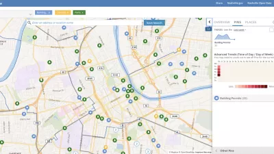
Presenting Municipal Data in an Interactive Map, Nashville Style
The city of Nashville launched the NashView interactive data map earlier this month.

Maui's Vacation Rental Debate Turns Ugly
Verbal attacks, misinformation campaigns and fistfights plague a high-stakes debate to convert thousands of vacation rentals into long-term housing.

Planetizen Federal Action Tracker
A weekly monitor of how Trump’s orders and actions are impacting planners and planning in America.

Chicago’s Ghost Rails
Just beneath the surface of the modern city lie the remnants of its expansive early 20th-century streetcar system.

Bend, Oregon Zoning Reforms Prioritize Small-Scale Housing
The city altered its zoning code to allow multi-family housing and eliminated parking mandates citywide.

Amtrak Cutting Jobs, Funding to High-Speed Rail
The agency plans to cut 10 percent of its workforce and has confirmed it will not fund new high-speed rail projects.

LA Denies Basic Services to Unhoused Residents
The city has repeatedly failed to respond to requests for trash pickup at encampment sites, and eliminated a program that provided mobile showers and toilets.
Urban Design for Planners 1: Software Tools
This six-course series explores essential urban design concepts using open source software and equips planners with the tools they need to participate fully in the urban design process.
Planning for Universal Design
Learn the tools for implementing Universal Design in planning regulations.
planning NEXT
Appalachian Highlands Housing Partners
Mpact (founded as Rail~Volution)
City of Camden Redevelopment Agency
City of Astoria
City of Portland
City of Laramie