


Ever dream of traveling from Rockland, Maine to Charlotte, North Carolina without using a car? With the Northeast Rail Map you can plan your journey via the East Coast's long-distance, regional, metropolitan, and heritage rail lines.
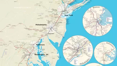
The team that created the California Rail Map and a speculative map of a U.S. high-speed rail system is at it again. Alfred Twu and his colleagues have mapped each passenger rial line from Maine to North Carolina, to scale, on one free map.
- Amtrak Northeast Corridor, long distance and regional passenger rail
- Amtrak Thruway connecting buses
- Commuter rail in the Boston (MBTA), New York (Metro North, LIRR, NJ Transit), Philadelphia (SEPTA), and Baltimore/DC (MARC, VRE) areas
- Tourist and heritage railroads
- Light rail, subways, and rapid transit
- Some connecting buses and ferries
FULL STORY: All northeast US passenger rail on one awesome map

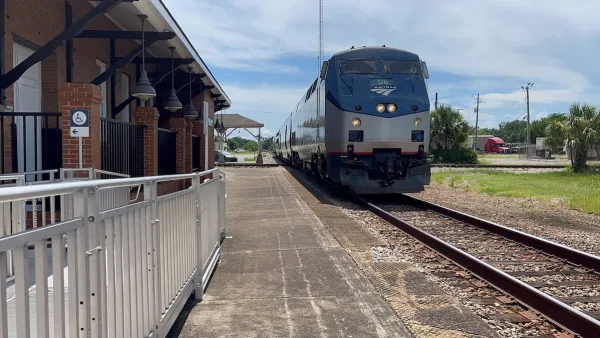
Amtrak Rolls Out New Orleans to Alabama “Mardi Gras” Train
The new service will operate morning and evening departures between Mobile and New Orleans.

The Subversive Car-Free Guide to Trump's Great American Road Trip
Car-free ways to access Chicagoland’s best tourist attractions.

Five Key Transportation Funding Proposals in Trump’s Budget
The President’s proposed 2026 budget would keep spending roughly the same for transit and rail and eliminate over $5 billion in funding for EV charging infrastructure.

Maui's Vacation Rental Debate Turns Ugly
Verbal attacks, misinformation campaigns and fistfights plague a high-stakes debate to convert thousands of vacation rentals into long-term housing.

Planetizen Federal Action Tracker
A weekly monitor of how Trump’s orders and actions are impacting planners and planning in America.

In Urban Planning, AI Prompting Could be the New Design Thinking
Creativity has long been key to great urban design. What if we see AI as our new creative partner?

King County Supportive Housing Program Offers Hope for Unhoused Residents
The county is taking a ‘Housing First’ approach that prioritizes getting people into housing, then offering wraparound supportive services.

Researchers Use AI to Get Clearer Picture of US Housing
Analysts are using artificial intelligence to supercharge their research by allowing them to comb through data faster. Though these AI tools can be error prone, they save time and housing researchers are optimistic about the future.

Making Shared Micromobility More Inclusive
Cities and shared mobility system operators can do more to include people with disabilities in planning and operations, per a new report.
Urban Design for Planners 1: Software Tools
This six-course series explores essential urban design concepts using open source software and equips planners with the tools they need to participate fully in the urban design process.
Planning for Universal Design
Learn the tools for implementing Universal Design in planning regulations.
planning NEXT
Appalachian Highlands Housing Partners
Mpact (founded as Rail~Volution)
City of Camden Redevelopment Agency
City of Astoria
City of Portland
City of Laramie