


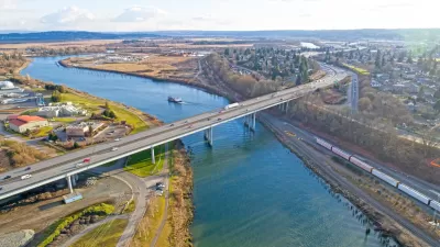
What if the great adventurer and geographer John Wesley Powell had his way: That as the western states were brought into the union their shape would be dictated by watershed rather than political boundary? This blog - and map - depict this scenario.
"This story begins with John Wesley Powell, the great one-armed adventurer and geologist. He was made famous for his successful runs through the Colorado River in 1869 and 1872. But perhaps his most important legacy rests in a lesser known deed: Proposing in 1879 that as the western states were brought into the union they be formed around watersheds, rather than arbitrary political boundaries," writes planner John Lavey.
"What if the western states were formed around watershed as Powell envisioned? What would that look like and could we speculate on what that might mean for the functioning of modern communities? And since we’re going down that road, what if all of the American states were based around principal watershed, from coast to coast – something even Powell didn’t consider?"
This piece, which originally appeared on the Community Builders network, examines the implications of such a scenario, and gives readers a view into what the "Watershed States" might look like via a map created by Lavey.
FULL STORY: The United (Watershed) States of America

Watershed States
This post from GOOD points to an old map of the Western U.S. in which state lines are redrawn based on the locations of watersheds.
Snohomish River Gains Legal Rights
A new law in one Washington town enshrines the river’s legal right to “exist, regenerate, and flourish.”
Dams on the Way Out on Two California Rivers
The largest dam removal project in U.S. history is about to commence on the Klamath River. Due to a recent development, a dam on the Eel River is also on expected for decommission.

Maui's Vacation Rental Debate Turns Ugly
Verbal attacks, misinformation campaigns and fistfights plague a high-stakes debate to convert thousands of vacation rentals into long-term housing.

Planetizen Federal Action Tracker
A weekly monitor of how Trump’s orders and actions are impacting planners and planning in America.

In Urban Planning, AI Prompting Could be the New Design Thinking
Creativity has long been key to great urban design. What if we see AI as our new creative partner?

King County Supportive Housing Program Offers Hope for Unhoused Residents
The county is taking a ‘Housing First’ approach that prioritizes getting people into housing, then offering wraparound supportive services.

Researchers Use AI to Get Clearer Picture of US Housing
Analysts are using artificial intelligence to supercharge their research by allowing them to comb through data faster. Though these AI tools can be error prone, they save time and housing researchers are optimistic about the future.

Making Shared Micromobility More Inclusive
Cities and shared mobility system operators can do more to include people with disabilities in planning and operations, per a new report.
Urban Design for Planners 1: Software Tools
This six-course series explores essential urban design concepts using open source software and equips planners with the tools they need to participate fully in the urban design process.
Planning for Universal Design
Learn the tools for implementing Universal Design in planning regulations.
planning NEXT
Appalachian Highlands Housing Partners
Mpact (founded as Rail~Volution)
City of Camden Redevelopment Agency
City of Astoria
City of Portland
City of Laramie