


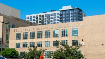
Schools are a prime driver of housing choices and transportation behavior. So why are schools and children often missing from the planning process? Ruth Miller diagnoses the problem and looks at how we can change it.
Miller discusses a couple of examples - one from the Bay Area's regional planning initiative and one from the siting of a new school outside of Covington, Georgia - for how schools are missing, and exempted, from the planning process. For a use that has such a high impact on housing and transportation choices, the disconnect is baffling.
"It’s one thing to exclude school boards from discussions of transportation and housing, but students themselves are routinely excluded, too," she continues. "Youth have a different, but incredibly useful perspective on a place. And children, especially young children, can be much more direct about their impressions of a place, if you’re willing to listen."
"Not only are youth scheduled out of opportunities for public participation, or made to feel unwelcome, but they aren’t given the tools to discuss these issues confidently with adults."
"A lonely few organizations are moving to fill this void, including the Center for Cities and Schools at the University of California, Berkeley (full disclosure, I am a graduate fellow). Their Y-PLAN (Youth Plan Learn Act Now!) curriculum presents a guide for teaching youth community participation. In addition El Carrito, a mobile public participation cart in the Fort Pienc neighborhood of Barcelona, and PLACE IT!, based in Los Angeles, both work from the point of view that people of all ages can work together on a vision for their city."
FULL STORY: The Self-Defeating Disconnect Between Cities and Schools


How Families Can Benefit the Planning and Design of Cities
An August 19 article in the Washington Post took a tough stance on the value of families to urban settings. Here Bradley Calvert responds by describing how families provide opportunities for planners to rethink cities for the better.
Concrete to Community: A Schoolyard Makeover in West Philly
With guidance from the Trust for Public Land, third graders at Overbrook Elementary are leading the redesign of their asphalt schoolyard into a vibrant green space, learning valuable skills and creating lasting community impact in the process.

Cities and Test Scores
The latest test scores from the National Assessment of Educational Progress suggests that student learning has not recovered from its COVID-era decline. Is this more true for urban school districts than for the rest of the United States?

Planetizen Federal Action Tracker
A weekly monitor of how Trump’s orders and actions are impacting planners and planning in America.

Maui's Vacation Rental Debate Turns Ugly
Verbal attacks, misinformation campaigns and fistfights plague a high-stakes debate to convert thousands of vacation rentals into long-term housing.

San Francisco Suspends Traffic Calming Amidst Record Deaths
Citing “a challenging fiscal landscape,” the city will cease the program on the heels of 42 traffic deaths, including 24 pedestrians.

Defunct Pittsburgh Power Plant to Become Residential Tower
A decommissioned steam heat plant will be redeveloped into almost 100 affordable housing units.

Trump Prompts Restructuring of Transportation Research Board in “Unprecedented Overreach”
The TRB has eliminated more than half of its committees including those focused on climate, equity, and cities.

Amtrak Rolls Out New Orleans to Alabama “Mardi Gras” Train
The new service will operate morning and evening departures between Mobile and New Orleans.
Urban Design for Planners 1: Software Tools
This six-course series explores essential urban design concepts using open source software and equips planners with the tools they need to participate fully in the urban design process.
Planning for Universal Design
Learn the tools for implementing Universal Design in planning regulations.
Heyer Gruel & Associates PA
JM Goldson LLC
Custer County Colorado
City of Camden Redevelopment Agency
City of Astoria
Transportation Research & Education Center (TREC) at Portland State University
Jefferson Parish Government
Camden Redevelopment Agency
City of Claremont