


A project by French artist Armelle Caron looks at what happens when you take the patterns of blocks that make up a city's form and organize and stack them sideways. Robert Krulwich investigates what such an exercise reveals about a city.
By dismembering, dissecting, categorizing, sorting and stacking the shapes that make up a city's blocks, Caron has constructed her own visual language of cities. So when you look at some of the urban areas that have come under her knife, what might they be saying? Krulwich takes a stab at translating some of the forms.
On Berlin: "Berlin, of course, contains mainly rectangles. It also has trapezoids,
triangles and, down in that last row, weirdly shaped squiggles that
represent actual city spaces. So, if you are walking through Berlin, the
cityscape isn't going to repeat endlessly. There will be surprises.
There are some totally irregular nooks and crannies there."
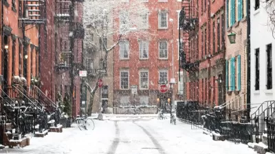
On New York: "Take away the bums, the fashionistas, the food carts, the cabs, the
colors, the smells, the sounds, cut it up and stack it on a table, New
York's grid system seems more than a little monotonous."
And on Istanbul, seemingly the most diverse set of blocks illustrated in the article: "Check out the top few rows - these are blocks, remember - and then
imagine wandering around these curves, angles, sudden narrowings.
Walking that city has to be amazing."
FULL STORY: Odd Things Happen When You Chop Up Cities And Stack Them Sideways

The Sweet Smell of Density? Subconscious Influences on Perceptions of Urban Form
Michael Hooper of Harvard University writes about a recent article in the Journal of Planning Education and Research
The Block Fallacy, or How Not to Build a Circulation System
An examination of the Block Ordinance as a panacea for the ailments of modern cities.
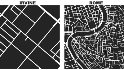
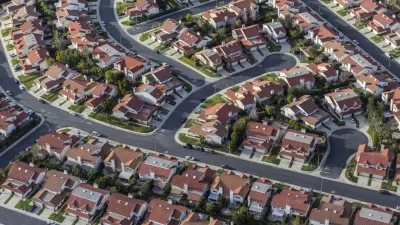
Friday Eye Candy: Comparing a Square Mile of the World's Famous Cities
Street networks and city blocks, reduced to their fundamental attributes, reveal the vast differences between cities.

Planetizen Federal Action Tracker
A weekly monitor of how Trump’s orders and actions are impacting planners and planning in America.

Maui's Vacation Rental Debate Turns Ugly
Verbal attacks, misinformation campaigns and fistfights plague a high-stakes debate to convert thousands of vacation rentals into long-term housing.

San Francisco Suspends Traffic Calming Amidst Record Deaths
Citing “a challenging fiscal landscape,” the city will cease the program on the heels of 42 traffic deaths, including 24 pedestrians.

Defunct Pittsburgh Power Plant to Become Residential Tower
A decommissioned steam heat plant will be redeveloped into almost 100 affordable housing units.

Trump Prompts Restructuring of Transportation Research Board in “Unprecedented Overreach”
The TRB has eliminated more than half of its committees including those focused on climate, equity, and cities.

Amtrak Rolls Out New Orleans to Alabama “Mardi Gras” Train
The new service will operate morning and evening departures between Mobile and New Orleans.
Urban Design for Planners 1: Software Tools
This six-course series explores essential urban design concepts using open source software and equips planners with the tools they need to participate fully in the urban design process.
Planning for Universal Design
Learn the tools for implementing Universal Design in planning regulations.
Heyer Gruel & Associates PA
JM Goldson LLC
Custer County Colorado
City of Camden Redevelopment Agency
City of Astoria
Transportation Research & Education Center (TREC) at Portland State University
Jefferson Parish Government
Camden Redevelopment Agency
City of Claremont