


I had heard of “dense sprawl” and “density without walkability” in the past, but before spending a week in Jerusalem last month, I had never really lived through these problems. My parents (who I was staying with) rented a unit in a high-rise condo complex called Holyland Tower. Although Holyland Tower was the tallest building in the area, there were numerous mid-rise buildings, and lots of two-and three-story apartment and condo buildings. While walking through the idea, I saw nothing resembling a single-family home. In sum, this area was a pretty dense neighborhood in a pretty dense city (Jerusalem’s overall density is roughly comparable to that of the city of San Francisco).

I had heard of "dense sprawl" and "density without
walkability" in the past, but before spending a week in Jerusalem last month, I had never really
lived through these problems.
My parents (who I was staying with) rented a unit in a
high-rise condo complex called Holyland
Tower. Although Holyland Tower
was the tallest building in the area, there were numerous mid-rise buildings,
and lots of two-and three-story apartment and condo buildings. While walking through the idea, I saw nothing
resembling a single-family home. In sum,
this area was a pretty dense neighborhood in a pretty dense city (Jerusalem's overall density is roughly comparable to that
of the city of San Francisco).
But although the density supported walking, the design did
not. To find the area, go to Google Maps
(maps.google.com) and go to a street called Avraham Perrera. You will note that the street is in a section
of looped streets that make the typical American cul-de-sac seem like a
masterpiece of clarity. As a result,
very little of interest is within walking distance, and what is within walking
distance is hard to find unless you know the area really, really, really well.
For example, the nearest restaurant is less than ¼ of a mile
away as the crow flies, but is about two miles away in reality. To get there, you have to go on five separate
streets. (To try it yourself, go to
Google Maps and ask for directions from Avraham Perrera to 5 Hose San Martin).
Because the succession of street loops is so confusing, even
places that are actually not very far are hard to find. For example, after I was in Jerusalem for a week I
discovered that there was in fact a small supermarket a ten or fifteen minute walk
away, but because of the messy street design (and admittedly, the rough terrain
as well) we were unaware of its existence.
By contrast, in a neighborhood with enough of a grid to distinguish
commercial from residential streets, commercial destinations are easy to
find. Admittedly, grids are more
difficult on hilly terrain such as that of Jerusalem.
But some American neighborhoods manage to combine walkability and hilly
terrain- for example, most of San Francisco, as
well as Philadelphia's
Manayunk.
So what my Jerusalem
neighborhood taught me was that with sufficiently poor street design, even a
fairly compact neighborhood may be more confusing to navigate, and separate
uses more aggressively, than some sprawling suburbs.


Opinion: What San Francisco’s Proposed ‘Family Zoning’ Could Really Mean
Mayor Lurie is using ‘family zoning’ to encourage denser development and upzoning — but could the concept actually foster community and more human-scale public spaces?
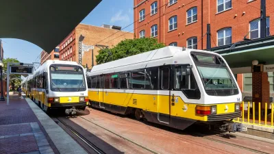
North Texas Transit Leaders Tout Benefits of TOD for Growing Region
At a summit focused on transit-oriented development, policymakers discussed how North Texas’ expanded light rail system can serve as a tool for economic growth.

California Bill Aims to Boost TOD
A bill proposed by Sen. Scott Wiener would exempt transit agencies from zoning rules near ‘high-quality’ transit stops and allow denser transit-oriented development.

Maui's Vacation Rental Debate Turns Ugly
Verbal attacks, misinformation campaigns and fistfights plague a high-stakes debate to convert thousands of vacation rentals into long-term housing.

Planetizen Federal Action Tracker
A weekly monitor of how Trump’s orders and actions are impacting planners and planning in America.

In Urban Planning, AI Prompting Could be the New Design Thinking
Creativity has long been key to great urban design. What if we see AI as our new creative partner?

King County Supportive Housing Program Offers Hope for Unhoused Residents
The county is taking a ‘Housing First’ approach that prioritizes getting people into housing, then offering wraparound supportive services.

Researchers Use AI to Get Clearer Picture of US Housing
Analysts are using artificial intelligence to supercharge their research by allowing them to comb through data faster. Though these AI tools can be error prone, they save time and housing researchers are optimistic about the future.

Making Shared Micromobility More Inclusive
Cities and shared mobility system operators can do more to include people with disabilities in planning and operations, per a new report.
Urban Design for Planners 1: Software Tools
This six-course series explores essential urban design concepts using open source software and equips planners with the tools they need to participate fully in the urban design process.
Planning for Universal Design
Learn the tools for implementing Universal Design in planning regulations.
planning NEXT
Appalachian Highlands Housing Partners
Mpact (founded as Rail~Volution)
City of Camden Redevelopment Agency
City of Astoria
City of Portland
City of Laramie