


Jay Walljasper writing in Yes! Magazine, reports on all the innovations that make Portland the premier cycling city in the U.S.
While investments are being targeted at physical infrastructure, Portland is also engaged in creating a culture of cycling through social marketing campaigns and celebrations.
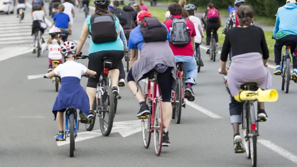
"[Portland's] plans signal a strategic shift in bicycle planning-a new push to serve more than the 8-10 percent of people who feel at ease biking today. Portland is now focusing on meeting the needs of the 60 percent of people who report in surveys that they're interested in biking more but feel nervous doing it on streets with cars zooming past. Currently, about two-thirds of Portland's 314 miles of bikeways are simple bike lanes, but the city is designing more bike boulevards (residential streets optimized for bike, rather than car, traffic), bike paths (off-street trails through parks or old rail lines), and cycle tracks (bike-only spaces separated from busy streets by a median, grade separation, or wide strip of painted pavement)...The new plan will push bike infrastructure to 5 percent of the city's total transportation budget."
Economic analysis is also revealing that these cycling investments are more than paying for themselves. It is estimated that the region is keeping $800 million in the local economy thanks to cycling, and that bikes are responsible for $1.5 billion in additional economic activity.
FULL STORY: Cycle City, USA

Unleashing the Power of Cycling With Smart Messaging
Lloyd Alter describes how creative design and copywriting can flip the script and promote active transport.

Pittsburgh To Revamp its Bike Share System With E-Bikes, New Stations
The system overhaul is partly due to nextbike's shift to focusing on its European markets. The new fleet will include 350 e-bikes and expand service to new neighborhoods.

Bike Share Coming to West Palm Beach
A new bike share system will bring 170 bikes to West Palm Beach as part of Brightline's new suite of door-to-door mobility options.

Maui's Vacation Rental Debate Turns Ugly
Verbal attacks, misinformation campaigns and fistfights plague a high-stakes debate to convert thousands of vacation rentals into long-term housing.

Planetizen Federal Action Tracker
A weekly monitor of how Trump’s orders and actions are impacting planners and planning in America.

In Urban Planning, AI Prompting Could be the New Design Thinking
Creativity has long been key to great urban design. What if we see AI as our new creative partner?

King County Supportive Housing Program Offers Hope for Unhoused Residents
The county is taking a ‘Housing First’ approach that prioritizes getting people into housing, then offering wraparound supportive services.

Researchers Use AI to Get Clearer Picture of US Housing
Analysts are using artificial intelligence to supercharge their research by allowing them to comb through data faster. Though these AI tools can be error prone, they save time and housing researchers are optimistic about the future.

Making Shared Micromobility More Inclusive
Cities and shared mobility system operators can do more to include people with disabilities in planning and operations, per a new report.
Urban Design for Planners 1: Software Tools
This six-course series explores essential urban design concepts using open source software and equips planners with the tools they need to participate fully in the urban design process.
Planning for Universal Design
Learn the tools for implementing Universal Design in planning regulations.
planning NEXT
Appalachian Highlands Housing Partners
Mpact (founded as Rail~Volution)
City of Camden Redevelopment Agency
City of Astoria
City of Portland
City of Laramie