


In a field such as planning that is rich with quantifiable data, why there so little focus on evidence rather than opinion?, wonders researcher Martin Laplante.
If you do a web search for the term "evidence-based medicine", you will find 1.5 million hits. "Evidence-based religion" gives 10,000 hits, surprising for a field where faith is so important. "Evidence-based urban planning" gives only 4 hits.
Why, in a field where so many of the objectives are quantifiable, is there so little focus on evidence rather than opinion? It's not that planning is lacking in quantification. Densities, square feet of floor space, number of parking spots, distance between certain uses, all of these get specified to three decimal points, but what seems to be lacking is evidence that changing these features of cities will achieve a measurable objective, while later evaluation to confirm whether they have achieved these objectives is typically not required.
Instead, the profession uses articles of faith based on data or analysis that is frankly insufficient to draw hard conclusions or that is extrapolated beyond what the original study might have established. For instance many studies have demonstrated that on average those who live in areas of higher population or unit density tend to drive less than those who live in lower density. What has less evidence to support it is to what degree increasing the density of an existing area will decrease driving and increase transit use. Even if density change has a predictable, measurable effect for marginal changes to low-density areas which take them from below to above the "transit-supporting" threshold, is there evidence that analogous changes will have an effect on medium and on high-density areas? Is there evidence that decreasing VMT in one area doesn't cause an increase in VMT in other areas?
I'm not saying that popular conclusions regarding the relationship between density and vehicle use are correct or incorrect, merely that I have seen no methodology for diagnosing and treating deviations from vehicle use objectives that uses evidence which is sufficient to support one decision rather than another. Planetizen readers are familiar with the use of a carefully selected published figure, outside the context from which it was taken, in order to justify a previously-held opinion. Density is controversial, but it's only one example among a great many articles of faith that are used to make planning decisions. LEED and LEED-ND are filled with numbers that are essentially an arbitrary consensus of a range of opinions with little solid scientific basis. Space precludes enumerating other numeric or point-based systems whose numbers are more opinion than evidence.
In my opinion, using assumptions and extrapolations to support large-scale planning policies and not using reliable predictions of scenarios nor evaluation of those predictions after the fact are common in part because urban systems are hugely complex and difficult to predict and in part because the planning process is largely political (not meant in a pejorative sense) and doesn't expect accurate predictions.
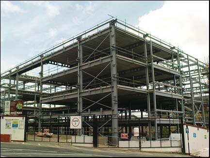
Traffic planning is an exception, of course. When the road system is not performing precisely as expected, hundreds of thousands of people who experience the discrepancy firsthand every day will demand an immediate change. Other aspects of urban planning do not have this immediately visible cause and effect. Traffic planning also tends to be carried out by engineers. They will gladly collect and crunch truckloads of data, predicting outcomes to within seconds and land required within inches, and then monitoring afterwards.
Even traffic planning models only hold as long as we keep all external variables, like buildings, uses, and economic factors, constant. Land use planning is not only all about these external factors, but about decisions made by a million individuals, which can take years to be translated into action. Without a microsimulation model of the players encompassing all of these interconnected factors, like the University of Washington's UrbanSim for instance, and trainloads of data and tuning, there is no hope of being sufficiently predictive to inform policy decisions.
The other problem is that urban planning consists of many disparate decisions years apart. The path through the cascading decisions from a comprehensive plan through to zoning and permits replace the issues of achieving specific objectives to ones of simple conformity with the letter of a document that was designed to be flexible and vague enough to avoid seeming arbitrary. None of the individual decisions are evaluated for achievement of overall objectives because no one knows in advance how many individual projects will be built and which of the many permitted choices will be selected. Overall objectives tend to be stated in the top level plans, the ones that have little ability to influence the individual decisions that will achieve those objectives.
When a cluster of road deaths or injuries is detected, transportation planners are notified and expected to fix the problem. But when the mental or physical health of individuals is affected by built form and distribution of uses, by pollution, the absence of safe places for children to play or the lack of jobs or affordable housing or good schools, no one thinks of holding urban planners to account, even if objectives were clearly spelled out in planning documents and not achieved. Expectations of predictability are so low and responsibility so diffuse that achieving objectives, if they are even measured, is an unexpected surprise. More often than not the planning documents were based on the fashionable beliefs of previous decades, about which current planners know little except that they were mistaken.
It's time to build an evidence-based urban planning discipline. It's a transformation of the profession whose time has come.
Martin Laplante, PhD, is Vice-President of RES Policy Research, an Ottawa-based consulting company. His consulting for municipal clients and business and community groups focuses on quantitative studies, models, and technology. He has been neglecting his blog, Reverse Zone, lately.

Explore US Demographics With the New ACS Atlas Collection
Esri's new ACS Atlas Collection offers interactive applications that visualize the latest U.S. demographic and socio-economic data, enabling users to explore over 175 curated web maps across various thematic areas.

Changing Travel Behavior: We Are Traveling Less, and More
We are in perhaps the most dynamic period with respect to changes in travel behavior in the past 50 years. Chose your data wisely.
A New Treasure Trove of Data on Mobility Services Is Now Available for Researchers
A shared post by Regina Clewlow, CEO and founder of Populus.

Maui's Vacation Rental Debate Turns Ugly
Verbal attacks, misinformation campaigns and fistfights plague a high-stakes debate to convert thousands of vacation rentals into long-term housing.

Planetizen Federal Action Tracker
A weekly monitor of how Trump’s orders and actions are impacting planners and planning in America.

In Urban Planning, AI Prompting Could be the New Design Thinking
Creativity has long been key to great urban design. What if we see AI as our new creative partner?

King County Supportive Housing Program Offers Hope for Unhoused Residents
The county is taking a ‘Housing First’ approach that prioritizes getting people into housing, then offering wraparound supportive services.

Researchers Use AI to Get Clearer Picture of US Housing
Analysts are using artificial intelligence to supercharge their research by allowing them to comb through data faster. Though these AI tools can be error prone, they save time and housing researchers are optimistic about the future.

Making Shared Micromobility More Inclusive
Cities and shared mobility system operators can do more to include people with disabilities in planning and operations, per a new report.
Urban Design for Planners 1: Software Tools
This six-course series explores essential urban design concepts using open source software and equips planners with the tools they need to participate fully in the urban design process.
Planning for Universal Design
Learn the tools for implementing Universal Design in planning regulations.
planning NEXT
Appalachian Highlands Housing Partners
Mpact (founded as Rail~Volution)
City of Camden Redevelopment Agency
City of Astoria
City of Portland
City of Laramie