


A string of connected parks laced through cities has been a vision of city planners since the days of Olmsted. Ben Welle of the Center for City Park Excellence has some ideas how that that vision can be implemented today.
Welle details how rail corridors, waterfronts and stream corridors, easements, underused streets, bike boulevards and cycle tracks can be used to connect parks into a network.
Welle writes, "All of these ways can be used to create linkages - one system may include an old rail corridor, a stream or river, an existing parkway and upgrading streets where none of those are possible.
Years ago, Frederick Law Olmsted remarked that no one should be a long walk's time from parkways, and that the citizens using them, whether going to and from a park, or to and from some form of business, may gain some 'substantial recreative advantage.' Today, it's not that different of a story."
FULL STORY: Getting Park Connectivity in Built-Out Cities

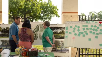
Public and Private Collaboration Advances Park Development in Houston
Houston may be known to some as a concrete jungle, but its greenspaces continue to expand thanks to combined support from the public, private, and philanthropic sectors.

After the Fires: Challenges and Efforts to Heal LA’s Parks and Trails
The recent LA wildfires have devastated parks and trails, with recovery efforts requiring extended closures, collaborative restoration plans, and community support to address extensive damage and long-term risks like landslides.
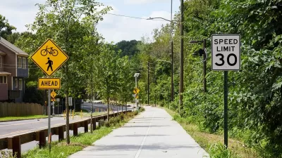
Atlanta Beltline Expands Westside Trail and Redevelops Rail Corridor
The Beltline is expanding the Westside Trail with new sections, including the Kudzu Trail, while also redeveloping abandoned rail corridors, with completion expected between 2025 and 2027.

Planetizen Federal Action Tracker
A weekly monitor of how Trump’s orders and actions are impacting planners and planning in America.

Maui's Vacation Rental Debate Turns Ugly
Verbal attacks, misinformation campaigns and fistfights plague a high-stakes debate to convert thousands of vacation rentals into long-term housing.

San Francisco Suspends Traffic Calming Amidst Record Deaths
Citing “a challenging fiscal landscape,” the city will cease the program on the heels of 42 traffic deaths, including 24 pedestrians.

Amtrak Rolls Out New Orleans to Alabama “Mardi Gras” Train
The new service will operate morning and evening departures between Mobile and New Orleans.

The Subversive Car-Free Guide to Trump's Great American Road Trip
Car-free ways to access Chicagoland’s best tourist attractions.

San Antonio and Austin are Fusing Into one Massive Megaregion
The region spanning the two central Texas cities is growing fast, posing challenges for local infrastructure and water supplies.
Urban Design for Planners 1: Software Tools
This six-course series explores essential urban design concepts using open source software and equips planners with the tools they need to participate fully in the urban design process.
Planning for Universal Design
Learn the tools for implementing Universal Design in planning regulations.
Heyer Gruel & Associates PA
JM Goldson LLC
Custer County Colorado
City of Camden Redevelopment Agency
City of Astoria
Transportation Research & Education Center (TREC) at Portland State University
Jefferson Parish Government
Camden Redevelopment Agency
City of Claremont