


In Boston for a conference, Mary Newsom reflects on the lessons that Sun Belt cities can take from historic cities like Cambridge to prepare for the future.
"It's cosmic irony of a sort that the cities most adapted to thrive in 21st-century America may well be our oldest. And those likely to have the toughest time adapting are new – Sun Belt metropolises such as Charlotte, which grew to cityhood in an era of auto travel, air-conditioning and exuberant suburban building.
As I love to do, I spent time last week just walking the old brick sidewalks of this pre-Colonial city across the Charles River from Boston. Although cars make life easier in Cambridge, you don't really need one, and the excellent regional transit system – buses, subways and commuter rail – isn't the only reason. Almost every street has a sidewalk. Cambridge manages to stay bicycle- and pedestrian-friendly despite sometimes heavy traffic. Equally important, there's an old-fashioned mix of stores and housing, so you really can dash out for a loaf of bread or take-out Thai and be home in 10 or 15 minutes. Apartment buildings and houses split into two or three condos sit close together, sprinkled among single-family homes.
Like many older U.S. cities, Cambridge was built in an era when land was treated as precious and wasn't routinely wasted on half-acre lawns or "buffers." It's compact and transit-friendly."
FULL STORY: Old cities can be models for the new

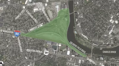
Imagining Alternatives to an Enlarged I-90 Viaduct in Boston
Massachusetts Department of Transportation plans to heighten and widen the Allston section of I-90 viaduct do not align with the community's desire for an environmentally friendly and pedestrian- and cycling-oriented new solution.
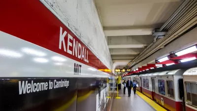
Tech Execs Call for More Public Transit Funding in the Boston Region
A Red Line train recently derailed on the T in Boston, providing the latest example of the need for drastic measures to course correct public transit in the region.
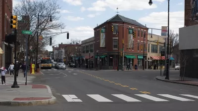
Cambridge Won’t Reach Goals to Curb Car Ownership
The city’s original plan to decrease car ownership isn’t quite panning out, even with more alternative transportation options for residents.

Planetizen Federal Action Tracker
A weekly monitor of how Trump’s orders and actions are impacting planners and planning in America.

Maui's Vacation Rental Debate Turns Ugly
Verbal attacks, misinformation campaigns and fistfights plague a high-stakes debate to convert thousands of vacation rentals into long-term housing.

San Francisco Suspends Traffic Calming Amidst Record Deaths
Citing “a challenging fiscal landscape,” the city will cease the program on the heels of 42 traffic deaths, including 24 pedestrians.

Amtrak Rolls Out New Orleans to Alabama “Mardi Gras” Train
The new service will operate morning and evening departures between Mobile and New Orleans.

The Subversive Car-Free Guide to Trump's Great American Road Trip
Car-free ways to access Chicagoland’s best tourist attractions.

San Antonio and Austin are Fusing Into one Massive Megaregion
The region spanning the two central Texas cities is growing fast, posing challenges for local infrastructure and water supplies.
Urban Design for Planners 1: Software Tools
This six-course series explores essential urban design concepts using open source software and equips planners with the tools they need to participate fully in the urban design process.
Planning for Universal Design
Learn the tools for implementing Universal Design in planning regulations.
Heyer Gruel & Associates PA
JM Goldson LLC
Custer County Colorado
City of Camden Redevelopment Agency
City of Astoria
Transportation Research & Education Center (TREC) at Portland State University
Jefferson Parish Government
Camden Redevelopment Agency
City of Claremont