


Federally identified ‘disaster resilience zones’ could receive more funding and resources to urgently address climate resilience and prepare their neighborhoods for future extreme weather.
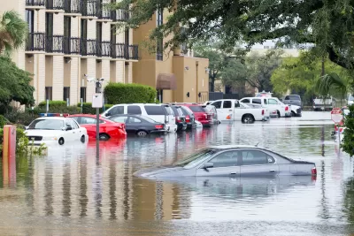
A federal measure of flood risk places more ‘disaster resilience zones’ in the Greater Houston area than any other county in the United States, writes Muizz Akhtar in Urban Edge. Census tracts are designated as disaster resilience zones for at least five years if identified as disadvantaged using the federal Climate and Economic Justice Screening Tool and if they rank in the top 50 nationally or top 1 percent of vulnerable communities in their state.
According to a FEMA press release, “these designations will help ensure that the most at-risk communities are able to build resilience against natural hazards and extreme weather events, which are becoming increasingly intense and frequent due to climate change.”
In Houston, “The 14 tracts are home to slightly less than 60,000 people, or just over 1% of the county's population, but they are also home to people who tend to have less resources to help them deal with extreme weather:” the population is overwhelmingly poorer than the rest of the county, while the housing stock is significantly older.
“According to a recent survey by the Kinder Institute, significant shares of Houstonians do not feel ready for the next disaster, with 44% saying not enough has been done to prepare (in terms of mitigation and resilience projects), 40% saying their community is not ready to recover from extreme weather and 42% saying their home is not safe from it.”

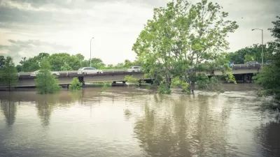
Criticism for Army Corps' Houston Flood Protection Plans
The U.S. Army Corps of Engineers has revised a plan to protect the Houston region from flooding by tossing out a proposed tunnel and opting instead to dig Buffalo Bayou wider and deeper.
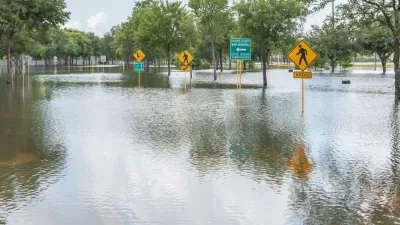
Houston Flooding: Climate Change or Development Patterns to Blame?
The Guardian's former environmental editor asks if urban sprawl is as much to blame as climate change for the flooding caused by Hurricane Harvey in Houston.

Planning Year in Review 2024: An Ongoing Housing Crisis, the Fight for Climate Resilience, and a Mixed Bag for Transportation
A pedestrian safety crisis, rising housing instability, and destructive extreme weather events set the stage for an eventful year.

Planetizen Federal Action Tracker
A weekly monitor of how Trump’s orders and actions are impacting planners and planning in America.

Canada vs. Kamala: Whose Liberal Housing Platform Comes Out on Top?
As Canada votes for a new Prime Minister, what can America learn from the leading liberal candidate of its neighbor to the north?

The Five Most-Changed American Cities
A ranking of population change, home values, and jobs highlights the nation’s most dynamic and most stagnant regions.

San Diego Adopts First Mobility Master Plan
The plan provides a comprehensive framework for making San Diego’s transportation network more multimodal, accessible, and sustainable.

Housing, Supportive Service Providers Brace for Federal Cuts
Organizations that provide housing assistance are tightening their purse strings and making plans for maintaining operations if federal funding dries up.

Op-Ed: Why an Effective Passenger Rail Network Needs Government Involvement
An outdated rail network that privileges freight won’t be fixed by privatizing Amtrak.
Urban Design for Planners 1: Software Tools
This six-course series explores essential urban design concepts using open source software and equips planners with the tools they need to participate fully in the urban design process.
Planning for Universal Design
Learn the tools for implementing Universal Design in planning regulations.
Village of Glen Ellyn
Central Transportation Planning Staff/Boston Region MPO
Heyer Gruel & Associates PA
Institute for Housing and Urban Development Studies (IHS)
City of Grandview
Harvard GSD Executive Education
Regional Transportation Commission of Southern Nevada
Toledo-Lucas County Plan Commissions