In Right of Way, Angie Schmitt explains why U.S. pedestrian fatalities have increased in recent years.


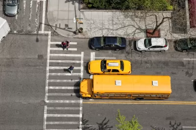
Over the past decade, the number of American pedestrians killed by automobiles has increased by 50 percent; by contrast, in Europe pedestrian death rates have actually gone down by 36 percent. What went wrong? In Right of Way: Race, Class and the Silent Epidemic of Pedestrian Deaths In America, journalist Angie Schmitt tries to explain what went wrong.
Schmitt suggests that the problem has a variety of causes, including:
- The combination of "killer roads" and demographic change. Sun Belt cities like Orlando and Tampa are the most dangerous for pedestrians, because they have the widest roads. (Where roads area wide, motorists can drive more rapidly—which means that a collision is more likely to be fatal than in a place with gentler traffic.) As more people have moved to those regions, more walkers have died. By contrast, most of the least dangerous metro areas are slow-growth regions like Boston and Pittsburgh. Even in the latter regions, suburbs have often grown faster than cities, so population has moved to more dangerous places. Schmitt notes that lower-income persons and persons of color are especially likely to be victimized in car crashes, and that as poverty has suburbanized, these persons are more likely to be in suburbs with wide roads. But if this were true, the number of carless households would have increased in the cities and neighborhoods with the highest fatality rates; Schmitt doesn't really address whether it is the case. (Since transit ridership in most cities declined in most of the late 2010s, I suspect that the opposite is the case; however, I have not really studied the issue).
- The growth of “killer cars.” Sport utility vehicles (SUVs) cause more than twice as many deaths per collision as sedans, primarily because of their height. Drivers of tall vehicles have more difficulty seeing pedestrians, and an SUV is likely to hit a pedestrian in the middle of the body instead of the legs, which in turn makes death more likely. “Bull bars” added to SUVs increase risks to pedestrians by concentrating the force of a blow; they are banned in the United Kingdom but not in the U.S.
- An aging society. A middle-aged man can walk 3.5 feet per second, while older people walk 2.5-3 feet per second. Traffic engineers time lights for a walking speed of 3.5 or even 4 feet per second, ensuring that older walkers are stranded in the middle of the road when lights change. If the number of older walkers has increased, the same number of crashes could thus lead to a higher number of fatalities. However, I have no way of knowing it has.
One common response to dead walkers is to blame the victim. For example, one study showed that only 25 percent of pedestrians seriously injured by cars were at crosswalks—implying that the rest were struck in midblock where people arguably should not be crossing streets.* However, Schmitt looked at the study more carefully, and points out that only 25 percent of seriously injured walkers were crossed at midblock. (The rest were injured in placers other than midblock or crosswalks, such as driveways and parking lots.) Moreover, crosswalks are infrequent in the suburban areas where injuries are most common, making it difficult for pedestrians NOT to cross midblock.
Schmitt shows that just as our pedestrian safety crisis has many causes, it is best addressed with a wide variety of small solutions. For example, the book discusses:
- Road redesign. In New York City, Queens Boulevard was narrowed by the addition of bike lanes, reducing the number of lanes walkers have to cross at a time. Between 1990 and 2014, 189 walkers died on this “boulevard of death” while in some recent years, none have.
- Changing traffic lights to give walkers a 5-7 second head start before vehicles get a green light.
- Lower speed limits, enforced by speed cameras. When New York City approved a pilot speed cameras program for school zones, injury crashes were reduced by 17 percent. *Street lighting. After Detroit repaired thousands of nonfunctioning streetlights, the pedestrian death rate fell 50 percent in two years—at a time when deaths were rising in the rest of Michigan.
- Imposing rules to make SUVs safer. Schmitt notes that European nations score cars on impacts to pedestrians, encouraging carmakers to introduce safety features to raise their scores.
Although I generally found Schmitt's analysis to be persuasive, there is one part of the book that I have reservations about. Schmitt devotes a chapter to attacking state and national Republicans, primarily for failure to fund pedestrian and bicycle facilities. Of course, some Republican legislatures are a target-rich environment in this area. However, this issue cuts across partisan lines. On the one hand, the wide roads that Schmitt properly condemns were mostly created in the late 20th century, when Democrats controlled most state legislatures; on the other hand, cities with Republican mayors and states with Republican governors have endorsed "Vision Zero" policies and other plans designed to make streets safer for walking and biking.
Even leaving aside the merits of the issue, Schmitt's emphasis on this point illustrates a broader trend that troubles me. My sense from reading blogs and listservs is that over the past few years, urbanist commentary has become more focused on appealing to left-leaning audiences. Given the dependence of Democrats on votes from car-dependent suburban areas, it seems to me unlikely that state legislatures will become radically more pro-walker without some Republican support. Thus, it seems to me that pedestrian advocates should be fighting for Republican support as well as tailoring their arguments to progressive audiences.
*I reject this view in this paper.

Debunking Traffic Safety Myths as Pedestrian Fatalities Increase
Angie Schmitt, former editor at Streetsblog USA, has written a new book about pedestrian fatalities, which works to dispel some of the myths about traffic safety in the United States.
How “Walking Audits” Can Improve Neighborhood Mobility
A simple walk through your community can reveal infrastructure gaps and highlight where cities can make streets safer for pedestrians.
Redesigning Streets for Livability: A Global View
An excerpt from the introduction of the recent book, “Streets For All: 50 Strategies for Shaping Resilient Cities,” edited by Vinayak Bharne and Shyam Khandekar.

Planetizen Federal Action Tracker
A weekly monitor of how Trump’s orders and actions are impacting planners and planning in America.
Data reveals that NYC’s bet on congestion pricing has paid off
After almost two years of the program, reports show positive impacts on traffic and air quality and no disruptions to parking.

HUD modernizes 50-year-old manufactured housing framework
The Next Generation Manufactured Housing Action Plan establishes new energy-efficiency standards for manufactured homes, and new guidelines for anchoring them.

Florida could lose billions in funding for infrastructure, parks
If Amendment 3 passes, Miami-Dade would lose about $445 million annually by fiscal year 2028-29.

New Mexico spent millions drafting climate goals. Data centers are unraveling them
Three data centers in New Mexico and El Paso will release more emissions yearly than 2 million cars in the same timeframe.

This Ohio town is using AI to speed up transit analysis
The Greater Dayton Regional Transit Authority’s new AI tool correctly determined riders’ preferred ways to reach key commuter routes.

FREE Course: Walkable City 1: Why Walkability?
After describing his path towards focusing on walkability as the essence of good planning, Jeff Speck marches through his five principal reasons for making more walkable places.
Reinventing Malls: Planning Alchemy—Turning Gray Fields Into Gold
The course focuses on the opportunities and imperatives that shape reinvention of mall sites.

Rutgers University, Edward J. Bloustein School of Planning and Public Policy
One Hundred Miles
County of Mendocino
The Architects Foundation
University of Cincinnati Online
Montrose County
Northern Illinois Transit Authority (NITA)
The Pocatello Development Authority


