The island's 40-acre park is a recreational destination, but waterfront advocates would like to see more use of Governor Island's shoreline and maritime infrastructure.


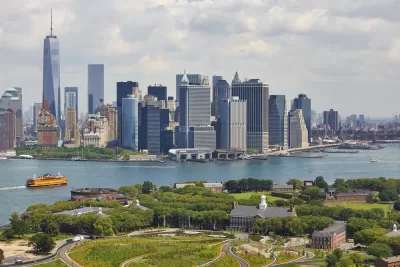
The Waterfront Alliance has released a new plan for Governors Island in New York, with a focus on the island’s 2.2 miles of coastline, reports Daniel Geiger:
Among the alliance's ideas are to create more places for visitors to explore the water, including by allowing access to a natural sand beach along Buttermilk Channel, which flows between the island and Brooklyn. A marina could be built to encourage recreational boaters to visit. Reorganizing the island's six working piers and boat landings could create more space for bigger vessels with scientific or historic value to dock.
Additional recommendations include increased ferry service between the island and various boroughs and separation of freight and garbage transport from ferry service. "The alliance wasn’t able to immediately say what its recommendations could cost to implement. Redeveloping piers to accommodate garbage and freight transfers and large visiting ships can run into the many millions of dollars," writes Geiger.
FULL STORY: Waterfront advocates set sights on Governors Island

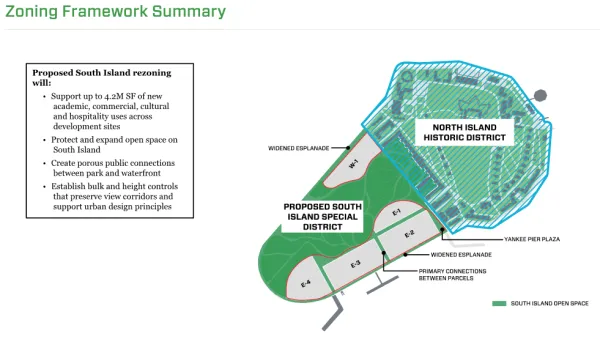
Rezoning for Governors Island Approved
A mix of new development focused on future needs and new tools for preservation are included in the rezoning package for the south end of Governors Island approved by the New York City Council in May.
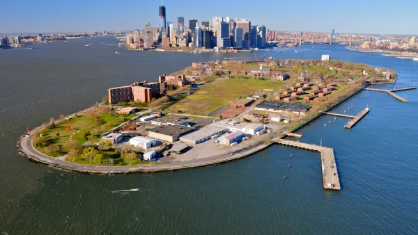
Massive Climate Research Center Planned for Governors Island, Rezoning Now Included
A speculative but exceedingly ambitious plan is pressing for air time in New York City.
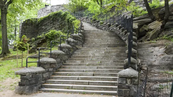
Aging New York City Parks in Desperate Need of Repairs
The city’s parks are facing a crisis on the horizon resulting from a lack of maintenance and growing capital improvement needs.

Planetizen Federal Action Tracker
A weekly monitor of how Trump’s orders and actions are impacting planners and planning in America.

The state-sanctioned urbicide of Austin
People don’t kill cities. Freeways do.

US to reduce Colorado River water deliveries to Mexico
A new Colorado Treaty amendment reduces Mexico’s Colorado River water allocation by 250,000 acre feet.

5 New England states march closer to 800 megawatt wind energy project
Securing federal approval for the project may be complicated under the Trump administration, which has historically been hostile towards domestic wind power.

Baltimore to break ground on $50 million Transit Priority Project
The project will bring faster bus trips, safer streets and better bike connections to Baltimore.

Airbnb launches $250 million 'last-dollar financing' housing accelerator, makes first investment in Austin
The company will put $6.4 million towards affordable housing development in Texas’ capital.

FREE Course: Walkable City 1: Why Walkability?
After describing his path towards focusing on walkability as the essence of good planning, Jeff Speck marches through his five principal reasons for making more walkable places.
Reinventing Malls: Planning Alchemy—Turning Gray Fields Into Gold
The course focuses on the opportunities and imperatives that shape reinvention of mall sites.

Eagle County Government
Harvard University Graduate School of Design
Nashville Planning Department
The Architects Foundation
University of Cincinnati Online
The Pocatello Development Authority
The Urban Renewal Agency of the City of Pocatello
Journal of the American Planning Association