The New York Department of City Planning is keeping itself on the cutting edge of internet technology.


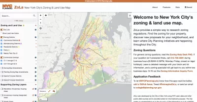
The New York Department of City Planning (DCP) recently announced updates to its Zoning and Land Use Application (ZoLa).
"ZoLa is a mapping tool that provides simple ways to research zoning regulations," according to a release announcing the upgrades.
Upgrades to the tool are intended to increase the tool's transparency, customization, and usefulness, with new functions like custom map creation, custom printing, street widths (previously available with the NYC Street Map), one-click access to the New York City Department of Housing Preservation and Development's Building, Registration, and Violation system, and easy access to special zoning district definitions.
The ZoLA upgrade is the latest in a string of web platform releases by DCP in recent years. Previous releases include ZAP Search, Zoning Resolution Online, Population Fact Finder, Community District Profiles, Metro Region Explorer, Waterfront Access Map, and NYC Street Map.
The in-house development team responsible for the ZoLa update, NYC Planning Labs, was recognized as a Planetizen Top Website in 2018.
FULL STORY: Increasing Transparency and Public Engagement: Department of City Planning Launches ZoLa 2.0


Will Urban Planners Lose Their Jobs to AI?
Let’s see what the data says.
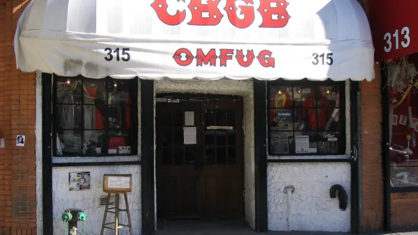
Opinion: Lower Rents Will Give Downtown Spaces Back to the ‘Weirdos’
Introducing the “CBGB theory of city planning.”
New York City Council Wants Community Engagement to Lead Affordable Housing Development
New York Mayor Eric Adams and City Council Speaker Adrienne Adams have proposed very different responses to the city’s lack of affordable housing.

Planetizen Federal Action Tracker
A weekly monitor of how Trump’s orders and actions are impacting planners and planning in America.

The state-sanctioned urbicide of Austin
People don’t kill cities. Freeways do.

US to reduce Colorado River water deliveries to Mexico
A new Colorado Treaty amendment reduces Mexico’s Colorado River water allocation by 250,000 acre feet.

Mamdani overhauls NYC's Vision Zero plan with 100 new policy goals
The overhaul aims to reduce traffic deaths and make streets safer for pedestrians, cyclists and drivers through lower speed limits, new safety infrastructure and more.

Amtrak not solely to blame for New Jersey commuter rail's unreliability, report finds
A new study from the Garden State Initiative found that NJ Transit’s budget grew 20% across a 4 year period, but reliability declined significantly over the same period.

EPA erases limits on planet-warming pollution from power plants
Under Monday’s plan, power plants would still have some limits on how much mercury, arsenic and other contaminants they can emit.

FREE Course: Walkable City 1: Why Walkability?
After describing his path towards focusing on walkability as the essence of good planning, Jeff Speck marches through his five principal reasons for making more walkable places.
Reinventing Malls: Planning Alchemy—Turning Gray Fields Into Gold
The course focuses on the opportunities and imperatives that shape reinvention of mall sites.

Eagle County Government
Harvard University Graduate School of Design
Nashville Planning Department
The Architects Foundation
University of Cincinnati Online
The Pocatello Development Authority
The Urban Renewal Agency of the City of Pocatello
Journal of the American Planning Association