A popular measure of walkability only measures proximity, not safety or comfort.


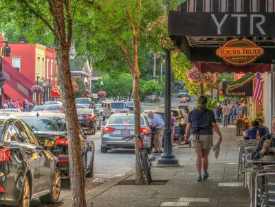
Early research from the Leeds School of Business reveals the limits of ‘walk scores,’ a metric often used by real estate websites to indicate the walkability of a neighborhood. The trouble with typical walk scores, explains Katy Marquardt Hill in an article for CU Boulder Today, is that they measure the proximity of stores, cafes, and parks — but not how comfortable or safe the walk there actually is.
To assess what makes people choose to walk or not walk to a destination, researchers studied anonymized travel data, tracking where people start and end their trips. “The way neighborhood amenities are arranged also influences whether people choose to walk, the researchers found. In already walkable neighborhoods, spreading shops and restaurants throughout several streets makes walking more enjoyable. In less walkable areas, clustering amenities along a single “main street” creates an attraction and encourages people to walk.”
According to Marquardt, “The findings have practical implications for urban planners, real estate developers and city officials.” They show that “targeted improvements like adding amenities along certain streets, improving pedestrian experience by adding trees or benches, or carefully locating parks, can make walking a more attractive option and potentially shift residents away from driving for short trips.” Seeing how people actually move through a city can help planners design places where people actually want to live. According to one lead researcher, “Designing a neighborhood should be human-centric. It’s not just about the map—it’s about the experience.”
FULL STORY: Why walkable neighborhoods aren’t just about distance


The number of kids walking to school dropped from over 50% to 11% since the 1960s
Unsafe pedestrian infrastructure makes walking to school dangerous or impossible for a growing number of American students.

On the Tradeoffs Between Sunlight and Walkability
There are five kinds of streets in this world.

Austin Suburb Launches Walkability Study
Kyle, Texas is developing a Sidewalks Master Plan to improve walking facilities.

The state-sanctioned urbicide of Austin
People don’t kill cities. Freeways do.

US to reduce Colorado River water deliveries to Mexico
A new Colorado Treaty amendment reduces Mexico’s Colorado River water allocation by 250,000 acre feet.

New Jersey’s second-largest city bans standalone data centers
Jersey City will continue to allow co-location facilities, such as those meant for research institutions that store their own data.

Amtrak not solely to blame for New Jersey commuter rail's unreliability, report finds
A new study from the Garden State Initiative found that NJ Transit’s budget grew 20% across a 4 year period, but reliability declined significantly over the same period.

EPA erases limits on planet-warming pollution from power plants
Under Monday’s plan, power plants would still have some limits on how much mercury, arsenic and other contaminants they can emit.

Phoenix announces new on-demand transit service, more frequent RAPID buses
Both new services will launch in October, and are part of Phoenix's Project Effective Access Solutions for Easing Congestion.

FREE Course: Walkable City 1: Why Walkability?
After describing his path towards focusing on walkability as the essence of good planning, Jeff Speck marches through his five principal reasons for making more walkable places.
Reinventing Malls: Planning Alchemy—Turning Gray Fields Into Gold
The course focuses on the opportunities and imperatives that shape reinvention of mall sites.

Eagle County Government
Harvard University Graduate School of Design
Nashville Planning Department
The Architects Foundation
University of Cincinnati Online
The Pocatello Development Authority
The Urban Renewal Agency of the City of Pocatello
Journal of the American Planning Association