A new national tree canopy assessment tool, available at TreesAtWork.org, provides high-resolution data to help cities track tree cover changes, prioritize planting efforts, and enhance urban resilience.


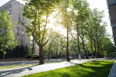
A new national tree canopy assessment tool is now available, providing cities across the U.S. with high-resolution data to evaluate local and regional tree cover and track changes over time. As urban areas face increasing challenges from extreme heat, storms, and air pollution, this tool equips community leaders with essential insights to prioritize tree planting and protection efforts where they are needed most. Developed through a collaboration between the Arbor Day Foundation, PlanIT Geo, and the USDA Forest Service Urban and Community Forestry program, the tool enables users to analyze land cover statistics, urban development patterns, and tree canopy data down to the census block group level, fostering more strategic and equitable urban forestry initiatives.
Hosted at TreesAtWork.org, the platform will continue to expand with additional data and resources throughout 2025, including a National Baseline Canopy Assessment Report that will provide an in-depth analysis of urban tree canopy trends nationwide. By offering actionable intelligence on tree loss and investment impacts, the tool supports cities in making informed decisions to enhance climate resilience, improve air quality, and expand equitable green infrastructure. As Dan Lambe, CEO of the Arbor Day Foundation, emphasized, this tool represents a significant step toward shaping healthier, more sustainable communities through strategic urban forestry planning.
FULL STORY: New National Tree Canopy Assessment Tool Now Live


A Plan to Expand Tree Canopy Across Dayton
Dayton is developing an urban forest master plan, using a $2 million grant to expand its tree canopy, address decades of tree loss, and enhance environmental equity across the city.

The Most Popular Tree on Google?
Meet Rodney: the Toronto tree getting rave reviews.
Montreal’s Gorilla Park Repurposes Defunct Railway Track
The park is part of a global movement to build public spaces that connect neighbors and work with local elements to serve as key parts of a city’s green infrastructure.

Planetizen Federal Action Tracker
A weekly monitor of how Trump’s orders and actions are impacting planners and planning in America.

The state-sanctioned urbicide of Austin
People don’t kill cities. Freeways do.

US to reduce Colorado River water deliveries to Mexico
A new Colorado Treaty amendment reduces Mexico’s Colorado River water allocation by 250,000 acre feet.

5 New England states march closer to 800 megawatt wind energy project
Securing federal approval for the project may be complicated under the Trump administration, which has historically been hostile towards domestic wind power.

Baltimore to break ground on $50 million Transit Priority Project
The project will bring faster bus trips, safer streets and better bike connections to Baltimore.

Airbnb launches $250 million 'last-dollar financing' housing accelerator, makes first investment in Austin
The company will put $6.4 million towards affordable housing development in Texas’ capital.

FREE Course: Walkable City 1: Why Walkability?
After describing his path towards focusing on walkability as the essence of good planning, Jeff Speck marches through his five principal reasons for making more walkable places.
Reinventing Malls: Planning Alchemy—Turning Gray Fields Into Gold
The course focuses on the opportunities and imperatives that shape reinvention of mall sites.

Eagle County Government
Harvard University Graduate School of Design
Nashville Planning Department
The Architects Foundation
University of Cincinnati Online
The Pocatello Development Authority
The Urban Renewal Agency of the City of Pocatello
Journal of the American Planning Association