


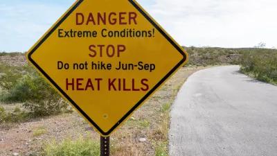
Two federal agencies launched a new, easy-to-use, color-coded heat warning system that combines meteorological and medical risk factors.

The National Weather Service and Centers for Disease Control and Prevention launched a new online heat risk system called the Heat Risk Dashboard, according to an Associated Press article in the Portland Press Herald. The new tool provides a simplified seven-day forecast that uses a color-coded rating system to indicate when temperatures could be a health risk.
Moving forward, magenta will signal the deadliest of the five heat threat categories, indicating rare, long-duration extreme heat with little to no overnight relief, while red will indicate temperatures that fall within the top 5 percent hottest for a specific date and location. Then comes orange (moderate risk), yellow (minor risk, mostly to the very young, old, sick, and pregnant), and green (little to no risk).
The move to a new rating system comes as extreme heat events become more frequent and intense because of climate change. According to a CDC press release, more than two-thirds of Americans were under heat alerts in 2023, and rates of emergency department visits for heat-related illness reached peak levels across several U.S. regions compared to previous years.
The tool was designed to be simple and easy for the public and medical practitioners to use. It could also be a valuable tool for local planners and other city departments when preparing for extreme heat events, which present a major public health threat that disproportionately impacts vulnerable populations and low-income communities, and communicating emergency response plans to community members.
FULL STORY: When red-hot isn’t enough: New government heat risk tool sets magenta as most dangerous level


How Extreme Heat Impacts Children
As summers get hotter and more dangerous, parents can take steps to protect kids from heat-related illnesses.
Record Temperatures Prompt Push for Environmental Justice Bills
Nevada legislators are proposing laws that would mandate heat mitigation measures to protect residents from the impacts of extreme heat.

Experts Call for Extreme Heat Action Plans as Communities Face Growing Risks
Experts are urging cities and counties to develop heat action plans and personalized heat warnings as extreme heat becomes a leading cause of climate-related deaths.

Maui's Vacation Rental Debate Turns Ugly
Verbal attacks, misinformation campaigns and fistfights plague a high-stakes debate to convert thousands of vacation rentals into long-term housing.

Planetizen Federal Action Tracker
A weekly monitor of how Trump’s orders and actions are impacting planners and planning in America.

In Urban Planning, AI Prompting Could be the New Design Thinking
Creativity has long been key to great urban design. What if we see AI as our new creative partner?

King County Supportive Housing Program Offers Hope for Unhoused Residents
The county is taking a ‘Housing First’ approach that prioritizes getting people into housing, then offering wraparound supportive services.

Researchers Use AI to Get Clearer Picture of US Housing
Analysts are using artificial intelligence to supercharge their research by allowing them to comb through data faster. Though these AI tools can be error prone, they save time and housing researchers are optimistic about the future.

Making Shared Micromobility More Inclusive
Cities and shared mobility system operators can do more to include people with disabilities in planning and operations, per a new report.
Urban Design for Planners 1: Software Tools
This six-course series explores essential urban design concepts using open source software and equips planners with the tools they need to participate fully in the urban design process.
Planning for Universal Design
Learn the tools for implementing Universal Design in planning regulations.
planning NEXT
Appalachian Highlands Housing Partners
Mpact (founded as Rail~Volution)
City of Camden Redevelopment Agency
City of Astoria
City of Portland
City of Laramie