


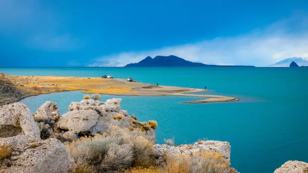
The BLM’s proposed maps could open up as much as 55 million acres to solar installations.

A debate over where to place solar installations on public lands is building in the West, writes Erin X. Wong in High Country News. In January, the Bureau of Land Management released a draft Western Solar Plan that offers five alternative maps for solar placement.
“The plan is focused on utility-scale solar projects that sell energy to utility companies that power cities and towns,” Wong explains. The plan estimates the West will produce 174.2 GW of power via solar installations, with up to 75 percent of arrays on BLM land.
Wong describes three of the plan’s proposed alternatives, which would allow solar development on anywhere between 11 million acres and 55 million acres, offering different levels of protection for cultural and ecological resources.
One alternative would open all land that doesn’t include protected resources, another would only open regions within a 10-mile radius of transmission lines, while a third would only make previously disturbed land available. “Ultimately, about 1 million acres of BLM land in the West will need to be developed to meet the nation’s clean energy goals, according to the draft analysis.” BLM says it will likely finalize the plan by the end of this year.
FULL STORY: The great solar build-out


BLM Allocates Funding to Study Renewables Impact on Public Lands
The large-scale study will assess how proposed solar farms and other renewable energy projects could impact animals, plants, and habitats.
Nevada and Utah Groups Oppose Public Land Sell-Off Plan
A set of last-minute amendments to the budget reconciliation bill open up over half a million acres of federally managed land to sales.
BLM To Rescind Public Lands Rule
The change will downgrade conservation, once again putting federal land at risk for mining and other extractive uses.

Maui's Vacation Rental Debate Turns Ugly
Verbal attacks, misinformation campaigns and fistfights plague a high-stakes debate to convert thousands of vacation rentals into long-term housing.

Planetizen Federal Action Tracker
A weekly monitor of how Trump’s orders and actions are impacting planners and planning in America.

Chicago’s Ghost Rails
Just beneath the surface of the modern city lie the remnants of its expansive early 20th-century streetcar system.

Bend, Oregon Zoning Reforms Prioritize Small-Scale Housing
The city altered its zoning code to allow multi-family housing and eliminated parking mandates citywide.

Amtrak Cutting Jobs, Funding to High-Speed Rail
The agency plans to cut 10 percent of its workforce and has confirmed it will not fund new high-speed rail projects.

LA Denies Basic Services to Unhoused Residents
The city has repeatedly failed to respond to requests for trash pickup at encampment sites, and eliminated a program that provided mobile showers and toilets.
Urban Design for Planners 1: Software Tools
This six-course series explores essential urban design concepts using open source software and equips planners with the tools they need to participate fully in the urban design process.
Planning for Universal Design
Learn the tools for implementing Universal Design in planning regulations.
planning NEXT
Appalachian Highlands Housing Partners
Mpact (founded as Rail~Volution)
City of Camden Redevelopment Agency
City of Astoria
City of Portland
City of Laramie