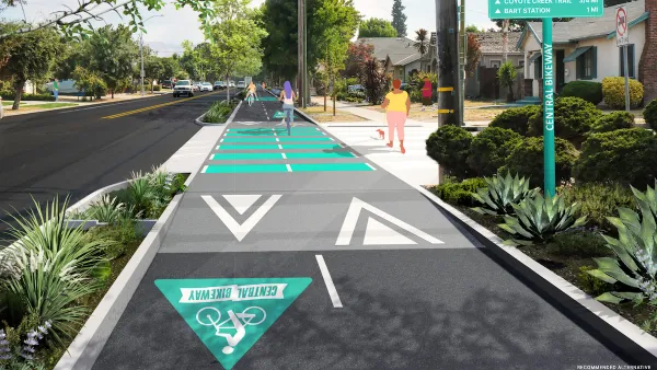
Narrowing lanes can improve road safety and reclaim space for other uses.

A new report from the Johns Hopkins School of Public Health concludes that narrower traffic lanes improve road safety. According to the report, “One major finding is that roads with 10–12-foot lanes at 30-35 mph speed limits have a significantly higher number of crashes compared to those with 9-foot lanes. Narrowing lane widths at these speeds provides city leaders with an opportunity to improve safety for all roadway users.”
Other key findings show that lane width affected safety on roads with speeds over 30 miles per hour and that narrower lanes “accommodate more users in less space, use less asphalt pavement, with less land consumption and smaller impervious surface areas.”
According to the report, “We found that the best candidates for lane width reduction projects are streets with 11–13-foot lanes in urban areas with speeds of 20-35 mph, as long as they are not used for heavy freight or transit.” The report recommends setting context-appropriate speed limits, factoring in pedestrians and other road users in planning decisions, setting a narrower lane standard, and using the extra space from lane narrowing for bike lanes or sidewalks.
FULL STORY: Narrow Lanes Save Lives

Planetizen Federal Action Tracker
A weekly monitor of how Trump’s orders and actions are impacting planners and planning in America.

Silicon Valley ‘Bike Superhighway’ Awarded $14M State Grant
A Caltrans grant brings the 10-mile Central Bikeway project connecting Santa Clara and East San Jose closer to fruition.

Amtrak Cutting Jobs, Funding to High-Speed Rail
The agency plans to cut 10 percent of its workforce and has confirmed it will not fund new high-speed rail projects.

Washington’s New Rent Cap Set Just Below 10% for 2026
Washington’s statewide cap on annual residential rent increases will be just shy of 10 percent next year, down slightly from its current level.

Nature Starts Here: The Essential Role of Nature Centers and Outdoor Programs
Nature centers and outdoor programs serve as vital gateways to environmental education, equity, and stewardship — bringing people closer to nature and inspiring the next generation to care for the planet.

Opinion: California Clean Transportation Efforts Not Addressing Needs of Low-Income Residents
The state’s rebate programs for e-bikes and other light electric vehicles are too underfunded to reach many of the Californians who need them most.
Urban Design for Planners 1: Software Tools
This six-course series explores essential urban design concepts using open source software and equips planners with the tools they need to participate fully in the urban design process.
Planning for Universal Design
Learn the tools for implementing Universal Design in planning regulations.
Caltrans
City of Fort Worth
New Jersey Institute of Technology
Mpact (founded as Rail~Volution)
City of Camden Redevelopment Agency
City of Portland
City of Laramie


