


The plan limits motorized recreation to protect natural and cultural resources.
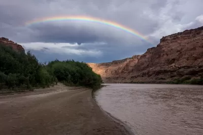
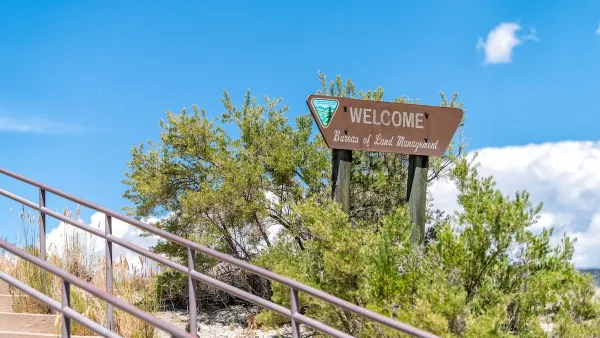
“On Thursday, the Bureau of Land Management released a new travel management plan for the Labyrinth Rims/Gemini Bridges area near Moab, Utah.” As Brooke Larsen writes in High Country News, the plan will affect over 300,000 acres of land that has seen a growing influx of recreational users, causing concern among environmental groups.
According to Laura Peterson, staff attorney with the Southern Utah Wilderness Alliance (SUWA), “The Labyrinth Canyon plan represents an important step forward to guide the management of Utah’s public lands and reduce the impacts of off-road vehicle routes in this area.” The plan restricts motorized recreation to just over 800 miles of routes, less than the previously available 1,200 miles, to protect sensitive riparian areas and wildlife, canyon rims, and cultural resources. “Georgie Pongyesva, a member of the Hopi Tribe and current tribal liaison for Grand Staircase Escalante Partners, told High Country News that the need to protect culturally important places in the Labyrinth Canyon area is connected to similar efforts across the Colorado Plateau.”
Larsen adds that “River runners have been especially concerned about ORV travel, citing its impact on the ecosystem as well as on their own recreation experience.” Living Rivers director John Weisheit says ORV users should be held responsible for protecting the environment, just as river runners are. The BlueRibbon Coalition, a motorized recreation advocacy group, plans to appeal the plan.
FULL STORY: Public-land recreation management near Moab gets an overhaul

Monument Review: Recreation a Larger Economic Benefit Than Ranching and Timber Combined
Why is the Department of Interior considering a reduction of the size of the Cascade-Siskiyou National Monument?
Most Public Lands Are Safe — For Now
A proposal to sell off federally owned lands was removed from the Republican spending bill on procedural grounds.
US Forest Service Could Open Millions of Roadless Acres to Logging
The USDA indicated it plans to repeal the ‘Roadless Rule,’ a Clinton-era regulation that prevents new road-building in undeveloped federal forest areas.

Maui's Vacation Rental Debate Turns Ugly
Verbal attacks, misinformation campaigns and fistfights plague a high-stakes debate to convert thousands of vacation rentals into long-term housing.

Planetizen Federal Action Tracker
A weekly monitor of how Trump’s orders and actions are impacting planners and planning in America.

San Francisco Suspends Traffic Calming Amidst Record Deaths
Citing “a challenging fiscal landscape,” the city will cease the program on the heels of 42 traffic deaths, including 24 pedestrians.

Defunct Pittsburgh Power Plant to Become Residential Tower
A decommissioned steam heat plant will be redeveloped into almost 100 affordable housing units.

Trump Prompts Restructuring of Transportation Research Board in “Unprecedented Overreach”
The TRB has eliminated more than half of its committees including those focused on climate, equity, and cities.

Amtrak Rolls Out New Orleans to Alabama “Mardi Gras” Train
The new service will operate morning and evening departures between Mobile and New Orleans.
Urban Design for Planners 1: Software Tools
This six-course series explores essential urban design concepts using open source software and equips planners with the tools they need to participate fully in the urban design process.
Planning for Universal Design
Learn the tools for implementing Universal Design in planning regulations.
Heyer Gruel & Associates PA
JM Goldson LLC
Custer County Colorado
City of Camden Redevelopment Agency
City of Astoria
Transportation Research & Education Center (TREC) at Portland State University
Jefferson Parish Government
Camden Redevelopment Agency
City of Claremont