


The city is building on a smaller test project that uses sensors to gather data about traffic movement to help transportation planners make more informed traffic management decisions.
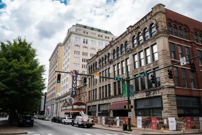
A ‘smart cities’ project in Chattanooga, Tennessee is creating a network of over 100 ‘smart intersections’ designed to inform better traffic management and map potential electric vehicle charging station locations.
According to an article by Maria Rachal in Smart Cities Dive, “The Chattanooga Department of Innovation Delivery and Performance, working with Seoul Robotics and the Center of Urban Informatics and Progress at the University of Tennessee at Chattanooga, are installing sensing technology in 86 downtown intersections, building on a testbed established in 2019.”
As part of the program, “sensors track and predict the movement of pedestrians and vehicles, which partners say allows them to better understand traffic flow and road user interactions, and identify potentially unsafe incidents.” The real-world data informs a ‘digital twin,’ a technology used to model potential outcomes. “The digital twin allows them to test and see how a change in traffic light timing, for example, could affect traffic flow.”
“While the earlier focus of the testbed largely centered on understanding safety issues surrounding vulnerable road users, [Center of Urban Informatics and Progress Founding Director Mina Sartipi] said this next phase of the testbed and its growing footprint will allow researchers to focus on ‘next-generation transportation,’ including electrification, connected vehicles, and potentially automated vehicles.”
FULL STORY: Chattanooga building out ‘smart intersection network’


Maryland Adopts Smart Signals to Keep Traffic Flowing
The new signals will respond to congestion in real time throughout the day.

Four Reasons Urban Planners Can’t Ignore AI
It’s no longer a question of whether AI will shape planning, but how. That how is up to us.

Top 10 Tech-Ready Cities
An index ranks U.S. cities based on their preparedness for the ‘smart city future.’

Maui's Vacation Rental Debate Turns Ugly
Verbal attacks, misinformation campaigns and fistfights plague a high-stakes debate to convert thousands of vacation rentals into long-term housing.

Planetizen Federal Action Tracker
A weekly monitor of how Trump’s orders and actions are impacting planners and planning in America.

Chicago’s Ghost Rails
Just beneath the surface of the modern city lie the remnants of its expansive early 20th-century streetcar system.

Bend, Oregon Zoning Reforms Prioritize Small-Scale Housing
The city altered its zoning code to allow multi-family housing and eliminated parking mandates citywide.

Amtrak Cutting Jobs, Funding to High-Speed Rail
The agency plans to cut 10 percent of its workforce and has confirmed it will not fund new high-speed rail projects.

LA Denies Basic Services to Unhoused Residents
The city has repeatedly failed to respond to requests for trash pickup at encampment sites, and eliminated a program that provided mobile showers and toilets.
Urban Design for Planners 1: Software Tools
This six-course series explores essential urban design concepts using open source software and equips planners with the tools they need to participate fully in the urban design process.
Planning for Universal Design
Learn the tools for implementing Universal Design in planning regulations.
planning NEXT
Appalachian Highlands Housing Partners
Mpact (founded as Rail~Volution)
City of Camden Redevelopment Agency
City of Astoria
City of Portland
City of Laramie