


The district’s small area plans (SAPs) are designed to ensure equitable economic and community development at the hyper-local level.

In a recent public meeting on the topic, the Washington, D.C. District Council assessed the Office of Planning’s draft Congress Heights Small Area Plan, which would guide development in the neighborhood. Reporting for Greater Greater Washington, John Besche outlines the plan.
“The CHSAP’s key recommendations deal with housing diversity and affordability, economic development, historic and cultural preservation, parks and public space, civic facilities, and transit for a neighborhood where 40% of residents live below the poverty line and 52% are in low food access areas,” Besche writes. “The District’s Office of Planning (OP) began working on the Congress Heights Small Area Plan (CHSAP), and several other Small Area Plans (SAPs), to complement its 2021 update of the Comprehensive Plan, a District-wide guiding document with a focus on equity and change.”
When councilors questioned the community involvement in the plan, Office of Planning (OP) interim director Anita Cozart said “Community dialogue involved confronting the history of inequitable community investment and the lack of access to resources like quality housing and safe public spaces. Data used in the plan was disaggregated by race and analyzed considering different impacts by race with benchmarks identified for achieving more equitable outcomes.”
The report recommends increasing density and supporting mixed-use development, improving access to fresh foods, creating more green space, and installing electric vehicle charging stations.
FULL STORY: DC Council considers how to plan for a more equitable future for Congress Heights

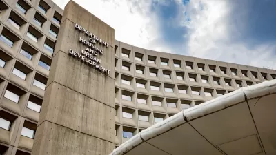
What Trump’s Executive Orders Mean for US Housing Programs
Orders related to DEI and accessibility, among others, may threaten housing programs for those who need them most.

The Philadelphia Loan Program Transforming the Demographics of Development
The Jumpstart loan program is helping Black and female residents become developers.

How the Trump Presidency Could Impact Urban Planning
An analysis of potential changes in federal housing, transportation, and climate policies.

Maui's Vacation Rental Debate Turns Ugly
Verbal attacks, misinformation campaigns and fistfights plague a high-stakes debate to convert thousands of vacation rentals into long-term housing.

Planetizen Federal Action Tracker
A weekly monitor of how Trump’s orders and actions are impacting planners and planning in America.

In Urban Planning, AI Prompting Could be the New Design Thinking
Creativity has long been key to great urban design. What if we see AI as our new creative partner?

King County Supportive Housing Program Offers Hope for Unhoused Residents
The county is taking a ‘Housing First’ approach that prioritizes getting people into housing, then offering wraparound supportive services.

Researchers Use AI to Get Clearer Picture of US Housing
Analysts are using artificial intelligence to supercharge their research by allowing them to comb through data faster. Though these AI tools can be error prone, they save time and housing researchers are optimistic about the future.

Making Shared Micromobility More Inclusive
Cities and shared mobility system operators can do more to include people with disabilities in planning and operations, per a new report.
Urban Design for Planners 1: Software Tools
This six-course series explores essential urban design concepts using open source software and equips planners with the tools they need to participate fully in the urban design process.
Planning for Universal Design
Learn the tools for implementing Universal Design in planning regulations.
planning NEXT
Appalachian Highlands Housing Partners
Mpact (founded as Rail~Volution)
City of Camden Redevelopment Agency
City of Astoria
City of Portland
City of Laramie