


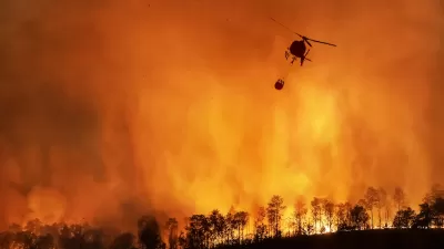
As Castle Rock faces an increasing threat of wildfires, town officials urge residents to use the recommendations in the plan to eliminate risks and protect their homes against future blazes.
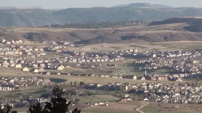
Castle Rock, located 30 miles south of Denver in a "very high risk" wildfire zone, has adopted a Community Wildfire Protection Plan aimed at making residents aware of hazards and regulating the design of buildings and surrounding vegetation, reports John Aguilar. According to the plan, local homes are threatened by "Flammable outbuildings, decks, projections, and fences," "decadent timber stands," and "natural and ornamental vegetation close to structures."
According to Aguilar, "It’s a hazard rating that has taken on a sharper significance and gravity since a wildfire blazed through southern Boulder County less than a month ago, destroying nearly 1,100 homes and damaging another 149 — a catastrophe that many homeowners never thought possible in a suburban setting miles removed from the fire-prone foothills."
The plan divides the town into 19 zones, assessing fire risk for each one. Only two areas are at "moderate" risk, while the other 17 are at "high" or "very high" risk. But while the plan seeks to identify threatened areas and risk factors, officials warn that "there are certain weather and environmental conditions that can’t be corralled or restrained by even the most capable firefighting forces."
Officials urge residents to evaluate their homes and properties for fire risk and take actions to mitigate the danger and consider ignition-resistant building materials and fire-resistant perimeters. Meanwhile, authorities are assessing ways to prevent the thousands of acres of parks and open space that make Castle Rock attractive to many locals from becoming a "highway for fire" in the event of a fast-moving blaze.
FULL STORY: Castle Rock just adopted a wildfire protection plan — but can it tame a Marshall fire-style burn?


California Insurers Call for Pricing Based on 'Catastrophic Modeling'
Home insurers argue they should be able to base policy costs on modeling that accounts for future risks from climate change and overdevelopment.
California Fire Dashboard Tracks Statewide Resilience Efforts
The online map builds a comprehensive database of fire prevention and mitigation efforts at every level of government to help agencies coordinate their work and understand the impacts of projects.
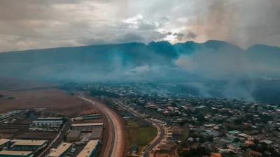
University of Hawaiʻi Researchers Assess Impacts of Maui Fires and Support Recovery
One year after the devastating Maui wildfires, UH researchers are addressing the disaster's impacts through studies on health, environmental contamination, disaster preparedness, and housing, aiming to support recovery and improve resilience.

Maui's Vacation Rental Debate Turns Ugly
Verbal attacks, misinformation campaigns and fistfights plague a high-stakes debate to convert thousands of vacation rentals into long-term housing.

Planetizen Federal Action Tracker
A weekly monitor of how Trump’s orders and actions are impacting planners and planning in America.

In Urban Planning, AI Prompting Could be the New Design Thinking
Creativity has long been key to great urban design. What if we see AI as our new creative partner?

How Trump's HUD Budget Proposal Would Harm Homelessness Response
Experts say the change to the HUD budget would make it more difficult to identify people who are homeless and connect them with services, and to prevent homelessness.

The Vast Potential of the Right-of-Way
One writer argues that the space between two building faces is the most important element of the built environment.

Florida Seniors Face Rising Homelessness Risk
High housing costs are pushing more seniors, many of them on a fixed income, into homelessness.
Urban Design for Planners 1: Software Tools
This six-course series explores essential urban design concepts using open source software and equips planners with the tools they need to participate fully in the urban design process.
Planning for Universal Design
Learn the tools for implementing Universal Design in planning regulations.
Gallatin County Department of Planning & Community Development
Heyer Gruel & Associates PA
JM Goldson LLC
City of Camden Redevelopment Agency
City of Astoria
Transportation Research & Education Center (TREC) at Portland State University
Jefferson Parish Government
Camden Redevelopment Agency
City of Claremont