


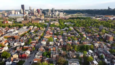
What does it mean to be a 15-minute city?

By Andres Duany and Robert Steuteville:
The 15-minute city is gaining significant traction politically and in planning circles, but what does it mean? Definitions vary, and there is so much slack in the concept—depending on what transportation modes are included—that even conventional suburban sprawl might qualify under some circumstances.
The term offers a two-fold opportunity for urbanists. First, the 15-minute city is a simple enough concept that it resonates with a wide range of people. It was used as a cornerstone of Mayor Anne Hidalgo’s successful reelection in Paris, France, in 2020, and lately former HUD secretary Shaun Donovan has adopted the concept as a key to his New York City mayoral candidacy. Urbanists have an urgent opportunity to help define the 15-minute city, and what it means to sustainable planning and urban design, before it is discredited as a mere political slogan.
Second, the concept can add substantively to the practice of urbanism because it deals with a neglected scale of planning that is larger than the neighborhood, but smaller than the metropolitan region. It shows planners where to locate facilities that serve multiple neighborhoods. It employs conceptual radii drawn on plans in a similar way to urbanists’ familiar quarter-mile "pedestrian shed."
Read more at the source article.
FULL STORY: Defining the 15-minute city

A Better Understanding of Smart Growth Benefits
Smart Growth creates compact, multimodal communities where residents consume less land, drive less, and rely more on non-auto modes. Planners have important stories to tell about the benefits of Smart Growth.

When Planning Issues Become ‘Culture Wars’
‘Commonsense’ urbanism projects are being painted by opponents as sinister plots to limit movement and erode property rights.
A New App Helps Identify 15-Minute City
The new 15-Minute City App generates maps which show the number of services and activities within a 15 minute walk, and and therefore whether an area can be considered a 15-minute neighborhood.

Maui's Vacation Rental Debate Turns Ugly
Verbal attacks, misinformation campaigns and fistfights plague a high-stakes debate to convert thousands of vacation rentals into long-term housing.

Planetizen Federal Action Tracker
A weekly monitor of how Trump’s orders and actions are impacting planners and planning in America.

Chicago’s Ghost Rails
Just beneath the surface of the modern city lie the remnants of its expansive early 20th-century streetcar system.

Bend, Oregon Zoning Reforms Prioritize Small-Scale Housing
The city altered its zoning code to allow multi-family housing and eliminated parking mandates citywide.

Amtrak Cutting Jobs, Funding to High-Speed Rail
The agency plans to cut 10 percent of its workforce and has confirmed it will not fund new high-speed rail projects.

LA Denies Basic Services to Unhoused Residents
The city has repeatedly failed to respond to requests for trash pickup at encampment sites, and eliminated a program that provided mobile showers and toilets.
Urban Design for Planners 1: Software Tools
This six-course series explores essential urban design concepts using open source software and equips planners with the tools they need to participate fully in the urban design process.
Planning for Universal Design
Learn the tools for implementing Universal Design in planning regulations.
planning NEXT
Appalachian Highlands Housing Partners
Mpact (founded as Rail~Volution)
City of Camden Redevelopment Agency
City of Astoria
City of Portland
City of Laramie